(Photos courtesy of GMARA)
Normally I don't go into much pre-race detail unless it's a big race. Or a freak hailstorm.
So we were driving after work from Albany up to Barre/Montpelier VT, on route to Hardwick for the start of GMARA's new "
Murky Excursion" overnight adventure race. It started raining, the sky got black, wind buffeted us, and then a torrential downpour slash hailstorm engulfed the car. It was mostly disconcerting in that we were about to start racing in a couple hours. Outdoors. In the dark. On bikes.
Much discussion ensued about what extra clothes to wear and carry. We also wisely stopped for pizza. After eating, the weather calmed down, and by the time we arrived at the school in Hardwick it was hardly sprinkling and we were treated to a double rainbow sunset! By the time the race started there were stars in the sky. Only an occasional flash of lightning in the distance gave any indication of the crazy evening leading up to the race. That was a close one.
This was a small race for GMARA (only 8 teams) but hopefully it will grow in future years. What a neat idea to race overnight! Then the rest of the weekend you can sleep and eat all you want, guilt-free :)
It was also an excellent final tune-up for me before Untamed New England. Especially the middle trekking section. More on that later.
Monkeying around for our pre-race photo:
Playing it straight for once:
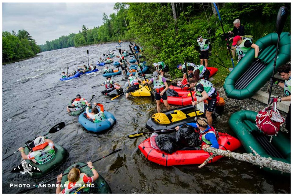
The race started at 10 p.m. with 3 points located in the trail system behind the high school. Except we were given only the topo map, not the trail map. This should be interesting...
Checking out the map before the start:
Lining up and getting ready to head off into the darkness:
We started with the "bridge" checkpoint, running up the hill on the street and jumping into the woods to find the creek and the bridge and the CP flag. As expected, there was a trail across the bridge, but also an intersection. We debated about the trail directions and took the right-hand split.
The trail was kind of going the right way, but too much uphill. We quickly cut down cross-country and located another trail. The direction on this trail was better, leading us across a little creek and up a hill. But there was no checkpoint on the other side, so we wasted a bit of time looking before backtracking to the next hill to the south.
Here we saw headlamps in the woods (more promising) but we began hitting intersection after intersection, and the contours were not so obvious in the dark. I happened to glance up to see a piece of paper posted on a tree - hey, that's a trail map! Complete with a "You are here" arrow - awesome!
An example map:
We studied the map, and I tried to make a mental note of the area around CP15 for the return to the finish line the next morning. We ran a very short ways to another intersection and found another map. I could get really used to this. Soon we were hoofing it up the red trail right to the next checkpoint. Another team had just found it from the other direction.
We ran around to find the "Sugar Road" (used for collecting maple sap from the network of tubes in the trees in this area). Back onto the red trail until we could hear a creek below us. I suggested that the trail would be the easiest way to the bottom, although with some added distance. John suggested we take the more direct route. Can't argue with that in a "it's good training" sorta way.
It was a steep drop, I need to practice that more often. I did a bit of kvetching, and then I did a sloppy map hand-off to John, such that the map made it down much more quickly that I did. Luckily it didn't land in the creek and find its way down to the Lamoille River...
Travel along the creek was only slightly easier - slippery rocks and limbs, crossing back and forth. I followed John as he made his way to the final checkpoint of this section. That was a good little adventure to get us started.
I had remembered a purple trail to the south, so we climbed up and easily found it, jogging back toward the high school.
The volunteer told us we were in 3rd place (we thought we had wasted more time than that) and 2nd place was 15 minutes ahead (that's more like it). Obviously the 3 guys from nationally ranked team Checkpoint Zero were somewhere very far ahead and not to be seen again until the next morning at the awards breakfast.
Team Checkpoint Zero:
We got ourselves somewhat organized for night riding and glided off into the night. It was nowhere near as graceful as I just made it sound.
John was experimenting with a new lighting system - a micro LED light clipped somewhere on his head (I'm not sure of the exact location he settled on) and his orienteering reading glasses. He was much more capable of reading the map while riding a bike compared to The Longest Day, so that went well. I was still loving my MagicShine helmet light. We rode through Hardwick and started climbing dirt roads south of town.
This bike section was mostly on dirt roads that were a bit soft from the rain, but not too rutted or pothole-y. It reminded me of riding around on back roads as a kid in northern Vermont. Except in the dark. Without dogs chasing us.
As we got close to CP4, John stopped to check the map and a couple guys rode up behind us. We were looking for the correct place to explore the powerline to our left. A short bit up the road we all skidded to a stop at a small trail going that direction. As the clue was "Trail", we decided to check it out.
There was no checkpoint there at the powerline, so the guys and John explored a little up the powerline itself. Seeing as there was no trail following the powerline (like in other places such as Bastrop), John and I decided to go back to the road and try further up the hill. That would match the map better anyway, according to Map Meister John.
A short bit more up the road and there was another trail. We dropped the bikes and ran up to find CP4. Nice job John!
We saw other headlamps approaching as we left the area. John mentioned that the powerline follows the road for a long way, so you better know where you are when you get in that area. We were happy to not spend too much time there.
Riding, uphill, downhill, mist, FOG, clear, stars, uphill, downhill, heading south for seemingly quite a ways but at least I had my odometer to tell me that it wasn't really all THAT far. One of the bigger downhills ended with a steep drop down into a thick fog with a little waterfall off to the side (we could hear it but not see it) and then a stop sign where the road ended. That was a bit of excitement to break up the work of riding.
I saw a deer and a deer saw me. A mouse scurried in front of our wheels. I spotted a couple beady eyes close together and close to the ground but could not tell what that was. Mostly it was quiet except for an occasional gust of wind that blew droplets of post-rain down on us.
Eventually we climbed a long hill to a saddle and dropped down to the little side road we were looking for. We had a recurring discussion about a gate that I won't go into because I still don't know why we talked about it so many times.
A little way up the hill we looked up to see CP5 up a steep rock face. John graciously scrambled up to get it. Such a sacrifice, John having to climb something...
Possibly John and possibly at CP5, but who knows really:
A coed team approached from the other way at the same time, not quite sure where they came from. We rode a bit further to the TA 2/3 bike drop and turned our attention to the big trek ahead. There was a campfire going which John exclaimed longingly about, but we weren't cold nor wet so he was able to get past it without getting drawn in.
There was a 4 a.m. cut-off to complete this section before having to ride directly to the finish and skip several biking points, and from the map it wasn't certain how tight this was going to be. We started at about 12:30 a.m. and there were 5 trekking points out in the middle of seemingly nowhere.
So we started off in a clockwise direction, aiming for the high peak first. Both of the possible "first point" options (this being an "any order" section of an obvious loop) did not look easy. At least if we could get into the right area of the peak, probably via bushwhacking and trying to follow a shallow ridge, finding the checkpoint should be straightforward - just climb up the mountain.
I saved the most "vague" checkpoint for last, the one in a clearing near a marsh in the middle of some flatlands. Hopefully we could aim for it from a closer checkpoint instead of plunging right into the woods and trying to stumble upon it from some distance away.
So, first things first. There was a logging road that didn't really go the right way, and it was pretty muddy and hard to travel on anyway. I took a northerly bearing to skirt one hill and try to find the ridge from there. John worked on mixing up a Spiz while I gingerly made my way through the underbrush and dense trees. Marshy bogs, downed trees, ferns with logs hidden under them, low branches, it was all rather bewildering right off the bat. I am SO not good at leading the way through this stuff.
Once John had the Spiz ready and we drank our shares, he took over in the lead position. Much better. This man can follow a bearing and take me around the worst of the crap, and more importantly, I trust that he is finding the best way (even if it's not always an easy way). I don't trust myself to do that, and it slows me down.
We got moving at a better pace, still slow though. The terrain was really quite something and I was very happy to have just a tiny bit of training for the Maine jungle later this month. Even if perhaps we were missing a better way via a trail or something (which we mostly were not but we always had to wonder), it was still good for me.
Finally the going got easier and we made our way up to the ridge. Look, a little trail! Just lovely. It went the right general direction, and I pace counted to bring us to the base of the mountain. The trail did not go up said mountain, just around it. But that's OK, we bushwhacked up it without too much difficulty. At the top - checkpoint! Score. Hmm, that took 50 minutes. A bit intimidating as a starting point, but we had time to try another CP and see if we could get faster (they were also closer together once you got "out there").
Back down the hill, luckily not too crappy but still a bit slow over some logs here and there. We were looking for a saddle and a creek to follow downhill. The terrain seemed to flatten out, and then John had us stop and listen for a second. Yep, definitely running water in that direction. Cool! Also cool was the moon showing through the trees. No light penetrated the canopy to help guide us, but it was fun to have a bit of company.
John followed near the creek while I pace counted. Again not fast on our feet but at least the checkpoint was easy to spot. And we took less than 20 minutes for that one. Things were looking up.
Following a bearing, the woods got more clear and we were able to start actually pressing the pace somewhat. We headed downhill (also helped for moving faster) and popped out on the trail we were looking for (the one trail on the map - it had better be there!). Not 100 meters north was the next checkpoint. Whoa, we cut that one a little too close for comfort...
Now we were gaining time and had hope for finishing this section by the cutoff. We took off running south on the trail, yay for actually running! I caught the correct trail heading straight at an intersection (an unmarked trail was going downhill in an enticing manner) and we continued to use the heck out of the pace counting to stay in touch with our approximate position. John found a good little drainage to follow upward and we started climbing through the crap again.
At the top was more marsh, more dense foliage, more running into branches, and eventually a checkpoint. 4 down! Now for the tough one.
We carefully followed a little creek until it turned south and merged with a second creek. Staying to the right and in the less-dense (but still sopping wet and mucky) bog, John led us toward the marsh. We could hear frogs and knew we were getting close. I started asking about it, based on my pace count, and John eventually headed into the wilder thicker toward the water.
Finding an actual body of water, John climbed out on a rock to look around. We determined that we were at the very south end of the marsh, just where it narrowed. The CP should be only 100 meters north. Our feet were already wet, so we tromped through some shallow water until John spotted the flag up ahead. Score! We were happy that the CP's were never overly hidden and always highly reflective so we didn't have to search around once we got in the right place. The "getting to the right place" was plenty challenging enough.
OK, now to get back to the bikes. We had over an hour and maybe 1.5 kilometers to get there. How hard could that be? Ha ha ha ha ha....
We started out with a solid plan and seemed to know where we were, not being sloppy (or so we thought), trying to pay careful attention and not just assume that we couldn't possibly mess this up. I thought we had a road and a mountain as backstops to the south, and I hoped if we got far enough west we could just head south from there to hit them.
We maneuvered around the south end of the next major bog, and then set off up-slope, picking our way over downed trees and through the ever-present low-lying vegetation and muck. John was on a southwest bearing and I continued to pace count. Eventually we found a logging road that was actually quite runnable - sweet! It went uphill and hit an even better road.
I picked the southwest-most direction and started off. John started to ask whether I thought this might be the actual "road around the mountain" that was supposed to be our back-stop, but he didn't say anything and that thought never made it to me via ESP. I just figured it was another random unmapped logging road. After all, it was rocky and rutty and pretty narrow for an actual road. Except that on the map it was marked as a trail in here, not a road...
I still liked the south and west direction it was taking us, even though it seemed like we should really be getting close to the TA by now. There was a drainage to the left, good, and a rise to the right, also good. I did hear a frog peeping and wondered "why is there a frog here?" when there shouldn't be anything resembling a pond in this area.
The more the road continued onward, the more concerned we got. I couldn't explain it. I knew we had not crossed this road when we started the trekking loop, so we couldn't be too far north. But wouldn't we have hit the mountain or the real road by now? At an intersection, another branch went north but really didn't seem right. Slightly panicked, we went south and ran a ways further until we hit an actual honest-to-goodness road. I thought it might be the one around the mountain. But suddenly I wasn't so sure.
We walked a couple steps west until I spotted the most fortuitous graffiti I have ever run into. It was a random spray painted figure on a rock, and I had seen it before. On a bike. A few hours earlier. Dang it to heck! At least we knew exactly where we were. And we knew where to go, and it involved running on a road with no bushwhacking involved, so that was something. Only 1.5 kilometers to go, and much less leeway than the previous time we had only 1.5 kilometers to go.
So we took off BACK the way we had come. The road had a small stream down the middle and quite a few rocks. I managed a nice slip-and-slide down one wet rock, landing on my butt. Sure, my lower limbs don't have to be the only wet and muddy parts of me. Past the singing frog in an actual pond, that made a lot more sense the 2nd time around.
We passed the point where we had joined this road - at the easternmost end of the loop. A correct read of our position at that point would have saved so much time.
Continuing on, we could smell smoke from the TA campfire and soon we emerged in the clearing to join the volunteers and several other teams. Phew! We had 10 minutes to spare, and we weren't sure what the final bike leg was going to throw at us. Only 2:10 to get to the finish line, let's boogie!
We biked down the dirt road and found the much-discussed gate, went around it and started down a muddy trail. I was a bit slow but worked on keeping up with John. We were with a couple other teams when we hit a confusing intersection and decided to try the right turn. That was heading uphill and John decided it looked too new to be on our map, so we headed back to try the straight option.
Much better, things started making sense again. We rode past a left turn and continued ahead to locate CP11. Nice nav, John.
We rode back to take the left turn (now a sharp right turn) and started picking up confidence and speed. It was also nice that the trail was going mostly downhill, and the uphills were minor. At another intersection we took another slight detour that turned out to be a driveway, then got back on track. The trail became smooth and quite pleasant, still with a gentle downhill slope. Based on the nice surface and the occasional orange arrow, I wonder if it might part of the VAST trail system.
Speeding along, we found CP12 next to the trail. The section between CP12 and CP13 was unclear on the map - we were heading from a "Trail" at CP12 to a "Trail" at CP13 but on the map there was nothing but a steep hillside without obvious easy passage. The race instructions told us we were not allowed on the paved road below us until after CP13. This section gave us some concern in advance, not knowing what we would find.
Well, the race director must be a kind soul, because we were to continue on the wide, gentle, downhill trail for another couple kilometers, and boy were we happy about that! CP13 showed up right on schedule. Now how to get down to the paved road?
We found a side trail heading steeply down, and it dumped us into someone's driveway - ? Quietly (as quietly as I could, what with my brakes squealing a bit and me not able to ride this slope without them) we made our way down their steep driveway to the pavement. The sky was already light and we were heading back to Hardwick.
But first - one more big hill. We decided we had time to try for CP14 at the top of the mountain across the way. Worst case, we figured we could get back down relatively quickly if we ran out of time.
So we found Buffalo Mountain Road (sounds promising) and started riding up, up, up. I even managed to stay in the saddle and ride a good percentage of it. Until I came to some large rocks or maybe some mud, can't remember exactly which, and had to get off. The road turned rocky and rutted after that, nothing I could reasonably expect to ride anyway. But we were almost to the top.
At the top - yay! We came upon the intersection with the road heading down the other side. I asked John what we were looking for and he gave me the distance down to the bottom. But aren't we also looking for a checkpoint? Oh yes! That's just down the way. I don't think we would have chosen to climb this hill otherwise :)
The top of the mountain was a sloppy, muddy mess with little drainage dips that stymied me along with big mud puddles. At least that didn't go on for very long, and there was CP14. Time to fly.
Or at least glide... or something... John took the lead and gave me lines to follow. Every time I rode over an obstacle, a section of rocks, a whoop-de-woo, I called ahead that I was "still on!" That gave me the strange idea to start talking to myself. You can do this. You got this. Oh yes, this one is no problem. OK, this one I'm not so sure about - but I'm still on! John was so patient and stayed the right distance ahead of me to help.
What a long, long way down... good practice...
Finally the bottom!
We rode over to the main road and found a team of a couple guys riding toward us. They had been looking for a way across the Lamoille River to CP15 on the other side. John led the way into a car dealership parking lot (?) and we explored the dirt parking lots in the back. I found a sign for a snowmobile trail, but it turned out to be a pile of signs being stored back there.
Just about to give up and ride into Hardwick proper to take the main bridge, John spotted a cut through the trees and amazingly located a gravel trail heading the right direction. It looked like a rails-to-trails thing, with a rocky surface but it was rideable. The only question - is there still a bridge in place? Yes there is! Sweet!
Across the river and a short ways south we found CP15. Last one! Only ~30 minutes to spare before the 6 a.m. cutoff.
From there we just needed to get up the hill and through the woods back to the school. One dirt road was going north. A small trail led south at the base of the hill. We chose that one. I told John we just needed to find the drainage that contained CP3 - and we did one better by spotting CP3 itself.
OK, let's bushwhack up to the purple trail! John suggested that there was this nice little trail over here. But John, we really need to go UP the hill first. I picked up my bike to demonstrate, and soon John had checked the map, figured out what I was talking about, and followed me up through the trees. The vegetation was reasonable and soon we were on the purple trail that we had previously followed at the end of the first trek. Awesome.
A short little ride back to the school and we were officially done. What a fun race! It was actually pretty easy to stay up all night, after not racing all day Friday nor getting up early the day before. We were both alert the whole time and John never needed a nap. The nav kept us entertained and we had a fun race. Nice.
Team Checkpoint Zero had finished at least an hour earlier, but we were the next team back with all of the checkpoints. We were pretty excited about that, after not being sure we would be able to clear the course. 2nd place overall, with a cool bag-o-prizes to boot. The post-race breakfast was particularly delicious (blueberry crepes and scones, anyone?). I love how GMARA prioritizes the post-race food!
GMARA puts on a heck of a fun adventure race, we will be back for the Bitter Pill in July.
Well done, teammie!
I'm pretty sure I was explaining our difficulties in getting back to the bike drop as John was turning in our passport...
Bag of award goodies:
The awesome GMARA crew:
The awesome breakfast:
We were so happy to have the rest of the weekend with Mom and Dad, several naps, and lots of sunshine and great weather. We topped it off Sunday in Burlington at the Himalayan Sherpa Kitchen, Lake Champlain Chocolates, and Magic Hat Brewery. A nice little vacation before the "big dance" next week... time to start packing.