This was a bigger, all-day (and into the evening) effort, ~49 miles from Mill Valley to Novato by way of the five highest peaks in Marin County, perhaps 10,000 ft. of climbing involving a bunch of ups and downs (large and small).
Here's the FKT page:
https://fastestknowntime.com/route/marin-high-5-ca
The excellent map I used (they have a really nice series of maps for the whole Bay Area):
http://www.redwoodhikes.com/Store/MtTam.html
It has been a few weeks since my most recent biggest effort at the Big Dog Backyard, which meant I started peppy and motivated and then gradually got tired and slower (but at least I was still motivated). A nice way to kick off the winter training season.
I got up silly-early, dropped off water bottles in 3 locations, parked the car at the park-and-ride lot in Novato, took 2 buses to Mill Valley, and started at the Depot just after 7 a.m. (the lengths I'll go to for these things!):

View from the starting spot, ready to head up the hill in the direction of Mount Tam:

A long set of stairs to kick things off:

What a lovely morning, a nice break from recent rains:

On the trail toward Mount Tam, hello sunshine!

Crossing Hoo Koo E Koo Road:

The excellent Temelpa Trail:

I'd assumed I wouldn't see too many trees on this run, so I was appreciating this shady section:

Almost to the top of the first climb:

Wow, I'd forgotten about the great views from up here, and also, thank goodness for clean air again!

And also, I'd forgotten that there are water fountains up here, the only potable water on this route that I'm aware of. On the other hand, it would have taken several minutes to fill my Camelbak so it was probably best that I carried the water with me up the hill instead.
The final trail to the summit:

Happy to be back on top of the East Peak of Mt. Tamalpais!

More great views:

When Andrew and Jim set up this challenge, they included "Mt. Tamalpais (All 3 Peaks just cuz)" so it was time to hit the other two. They were mostly on the way anyway and not much extra climbing, so it seemed like a great idea.
The start of the road up to Middle Peak:

Parking lot on Middle Peak:

What seems to be the "high point" of Middle Peak, this boulder on the west end of the parking lot:

The lovely trail coming down from Middle Peak:

Tree moss:

Aiming for West Peak, I saw some little trails heading up into the bushes and instinctively jumped on them to try for a shortcut. That turned into a bit of bushwhacking and following a fence and roads around, eventually I made it here:

At the bottom of the road I found signs that suggested the West Peak is off-limits (confirmed with some online searching later), so I'd say it should probably be removed from this challenge:

Heading west and finding a rather odd abandoned area, must have been an interesting place to live at one time:

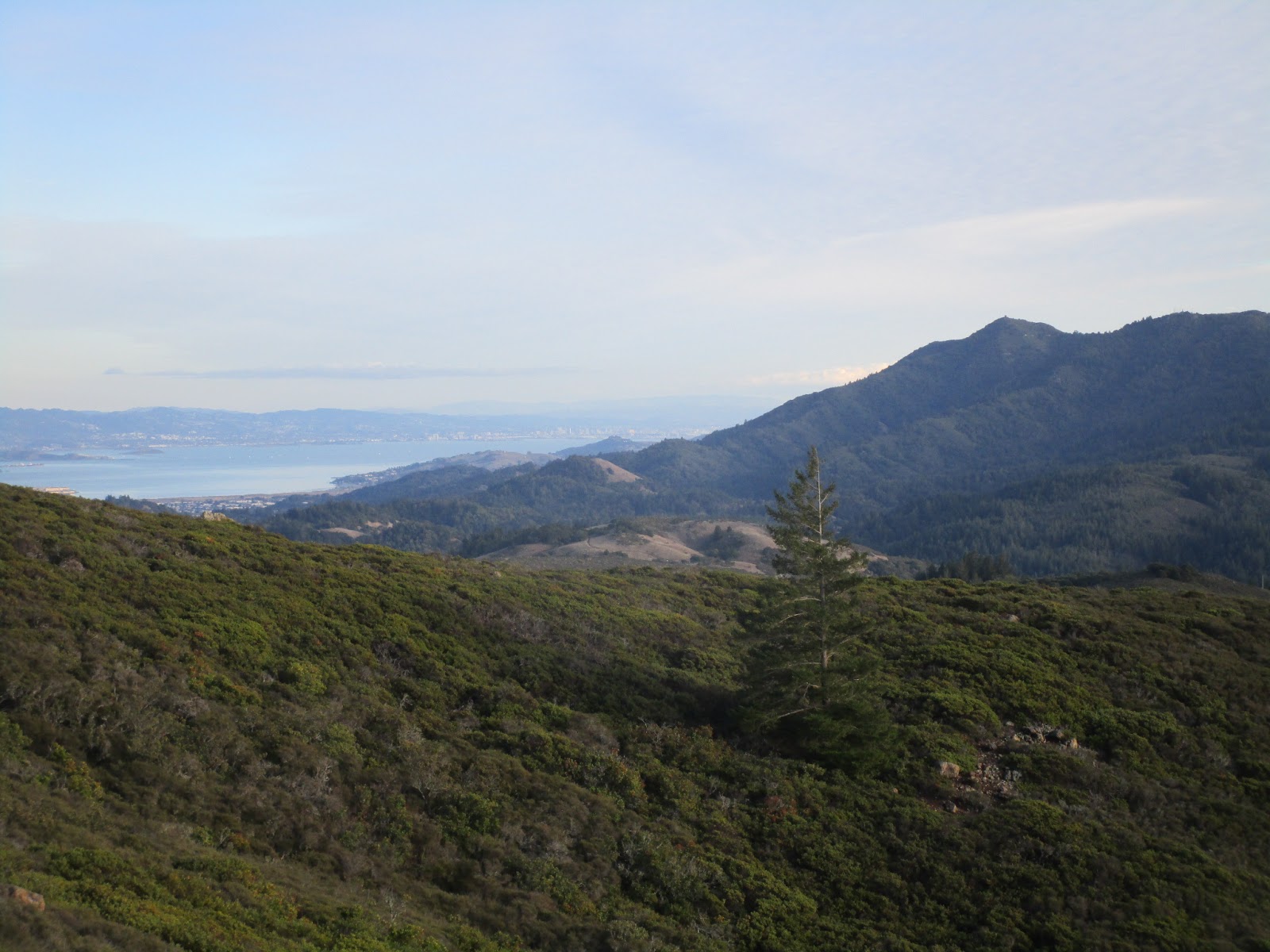
The view toward Bolinas Ridge and the ocean beyond:

Mountain Top Trail, another fun little run heading down the hill:

2nd bathroom opportunity (no potable water this time), at the start of West Ridgecrest Boulevard:

Apparently if I had arrived earlier I might have had the road to myself for a while (as it was there weren't many cars):

Following the road for a couple miles with great views to the north and west:

Looking down at Bolinas Lagoon:

The connection to the Coastal Trail:

And I'm back on the Bay Area Ridge Trail, awesome!

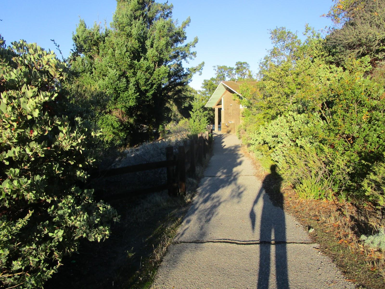
Shadow dancing:

The cutest little bench ever:

I was happy to be off the road so I could start listening to my iPod. First up, the Fastest Known Podcast (how appropriate), and this week's episode was a live Q&A. I happened to catch either Peter or Buzz say "If you can't be fast, be first" - hey, that's me! I'm not fast, but I'm enjoying being the first woman on these longer FKT routes. This opportunity won't last forever, I'm sure, but it's a lot of fun at the moment.
BART trail winding around the hillsides:

Hey, redwoods, excellent!

The end of the Coastal Trail and the start of the fire road along the top of Bolinas Ridge:

More woods and shade, and even though it was a cool day, I didn't mind getting out of the sun for a while:

Lots of little ups and downs along the ridge (but that was nothin' compared to the ridges to follow...)

Another great view of the lagoon and the ocean:

Very happy to be running in the trees:

And I didn't mind running in the fields either:

But I was still ready to be done with Bolinas Ridge by the time I finally reached the turn-off onto the Shafter Grade fire road:
Sweeping downhill to the creek at the bottom:

And the next (I think last?) porta-potty of the route is at the Peters Dam parking lot. I had stashed water here, so I stopped for a few minutes to refill my Camelbak and mix some Spiz. And get my pack slightly wet when I didn't close the bladder well enough (I really need to learn that better). And spend more time fixing it and getting everything stuffed back into the pack. I think I need a running vest with more capacity to replace my running pack for these longer days...

Well, that led to my low and slow point of the day, carrying a lot more weight now and trudging up a long hill, up San Geronimo Ridge Road:

I had originally thought I might finish in 15 hours, recalculated to maybe 14 hours early in the day, and now I was back to thinking 15 was more likely. This part took a while. But it was pretty and I had podcasts, no worries.

Right about here I started thinking "boy, I really should have gotten clarification on whether I need to follow the original route exactly or if I just need to get from peak to peak." There's a split onto Hunt Camp Road that looked like it would save a little distance and climbing, but since I didn't have an answer to that question I stayed with Andrew and Jim's route.

Yes, it had also occurred to me that I had already done a shortcut up to the West Peak of Mount Tam, so when I finished I got clarification that this was indeed a "free course" so I could have taken other alternate routes to the peaks. Good lesson about asking questions beforehand next time.
View across to the Pine Mountain Ridge:

It was a rather long and circuitous route to the edge of Kent Lake and then back up the other side, and it didn't help that I was moving slower. At least the fire road was wide and runnable:

A couple small creek crossings:

Wonderful fall colors (it's subtle around here, but you can see "autumn" if you're looking for it):

And back to the "high country":

A view toward Mount Tam to the south:
Wow, that ridge goes up and down and up and down A LOT, and the fire road barely tries to avoid the bumps. My initial elevation calculation based on the major peaks and valleys was sorely underestimated.
Pine Mountain for peak #3! It was a little ways off the road but there's a good path leading up to it. Best I can tell, here's the summit rock:

Better camera lighting on the rock:

The little trail coming off the road leading to the highpoint:

And I still have plenty of daylight, cool. And a lighter pack and legs that are ready to run downhill. I was also quite pleased about the road conditions even after all the recent rains. No sticky mud, just occasional puddles. This was probably the worst section and it was easy to deal with:

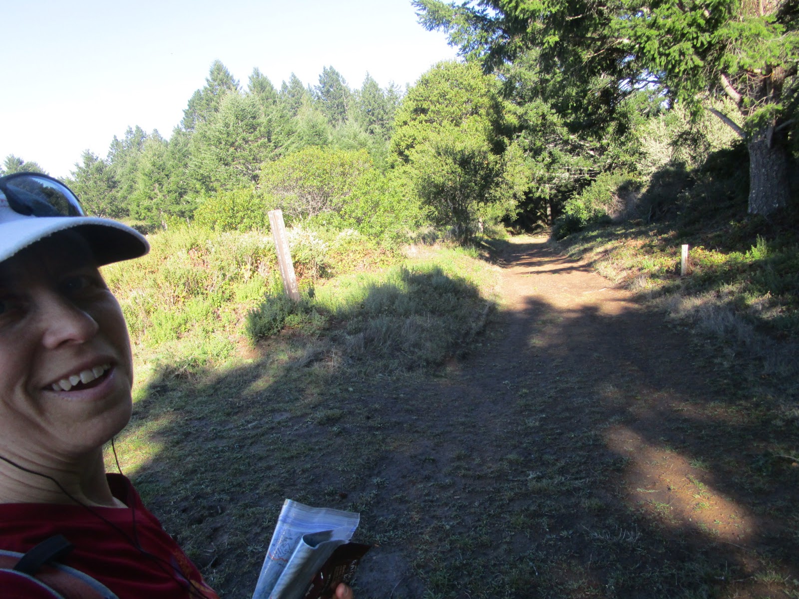
Back to needing to follow the intersections on the map more carefully for a while:

Back on the Bay Area Ridge Trail, yay!

Coming down the White Hill Trail, this tall post reminded me of some trail markers up in the San Juan Mountains; are they expecting deep snow here too?

The trail crossing under Sir Francis Drake Boulevard and my 2nd water cache, made it just before the end of daylight:

Another heavy pack, for the final time today. Starting up toward Loma Alta on the north side of the road:

It was a straightforward climb up the hill, except for all the cows. Every single one had a calf next to her, and every single one stared at me suspiciously. "It's OK cows, just passing through". There was mooing involved.
At the top of Loma Alta, with lights to the east. There's nothing up here to prove my location in a photo, so I hit the "OK" button on my InReach as verification.

See, I'm on top of Loma Alta!

Coming down the north side, I did some "cow avoidance" and tried to minimize disturbing the bovines. Turns out I missed seeing an intersection I was looking for, so I was confused when the road started downhill to the left. It took a couple minutes and getting out my phone to realize that, duh, I was further along than I had thought. That's a rather embarrassing error to admit. At least I wasn't actually lost. Just confused.
Moving on. I had one more bottle at the Lucas Valley road crossing but didn't need it (it just added to the crunched-up bottles squeaking from inside my pack). Time for one more big climb!

It was a lovely night for a trail run. The climb went by fairly quickly and soon I was on Big Rock Ridge. I passed the high point by the tall towers and started the long run east down the ridge.
"Down" meaning down, then up, then more down, then up, repeat over and over. Again, the road constructors were committed to following the top of the ridge. If you get tired of running downhill, don't worry. You'll have to climb a steep section in a few minutes.
Into Lucas Valley Open Space Preserve:

Such lovely, peaceful views all around, communities lit up but no sounds yet reaching me.
Eventually as I descended I started hearing the roads. Happy to be almost done.
The gate near the bottom, only notable in that I finally stepped in a puddle right after I took this photo, gak! Ah well, I suppose having a wet foot on the drive home is preferable to running in a wet shoe all day.

The finish spot in Novato at the intersection of Nave/Alameda del Prado - time to STOP:

I split the difference almost exactly between my 2 estimates:

Mount Tam
East Peak 1:19
Middle Peak 1:42
West Peak 2:02
North end of Bolinas Ridge at Shafter Grade 4:49
Pine Mountain 8:32
Loma Alta 11:00
Big Rock Ridge at the antenna towers 12:56
Not that I'm counting, but I now have 13 FKT's on the website, which is only notable because it puts me temporarily next to Kilian Jornet!! Probably the only time in my life I will be listed next to Kilian, so that required a screenshot. And a mention here:

Fun route, interesting challenge, and an excellent training run.