This purpose of this post is to describe and document the new Dumbarton Loop FKT route. It's not one of my normal "this is what I've been up to" blog posts, so unless you're planning to run this FKT, you probably won't be all that interested in these photos. And fair warning, there are a lot of photos...
The page for this FKT:
https://fastestknowntime.com/route/south-bay-dumbarton-loop-ca
(Initial route) GPS data collected with Kip's watch during my run this week (with a detour around the San Francisquito Creek closure):
https://connect.garmin.com/modern/activity/3045440547
Current route, detour no longer needed:
https://connect.garmin.com/modern/activity/3354132411
The start/finish spot on the loop is for you to decide, also the direction you run it. This documentation starts at Holger/North 1st Street and goes in the clockwise direction. I'm mixing photos from 3 different training runs, FYI (so the weather is a bit different photo-to-photo).
My starting spot for this week's run - just before dawn, on Holger Way looking onto North 1st Street:

I crossed North 1st and headed north to find the bike path (it starts at the entrance to Oak Crest Estates):

The bike path along 237:

Continuing along 237, at the intersection with Guadalupe River Trail:

Just on the other side of Guadalupe River:

A jog to the right on Lafayette to follow the trail to the north side of 237:

Continuing along 237, now on the north side:

Where the trail crosses Great America Parkway:

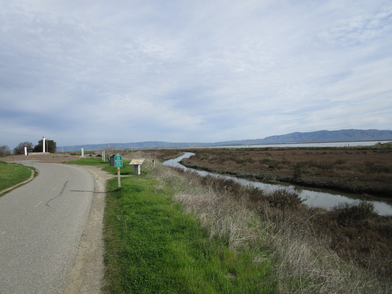
Heading toward Baylands Park and the beginning of the more scenic section:

Follow the Bay Trail to the right at Calabazas Creek:

A link that might be useful for the Bay Trail on the west side:

First bridge over a canal:

On the other side of the bridge; there are Bay Trail signs to follow, not always obvious though:

And occasionally they are confusing; this one caused me to divert once to a little trail that ended up heading out into the Bay (don't do that). Stay left here along the back side of the wastewater treatment plant:

The trail comes inland briefly to parking lot access on Carl Road:

Good place to fill up on water (and there is usually a porta-potty here, no guarantees on what condition it's in):

Crossing the canal to head back toward the Bay:

The left turn back onto the trail between canals; I believe this isn't well-signed, something to watch for:

Peaceful running along the canals:

This probably had a purpose once; I don't think you can go through this gate now:

A little Bay Trail arrow at a canal crossing:

Continuing west (only one option, no nav issue):

Golf course across the way, and a view toward the southern hills:

More dirt trail on a quiet morning:

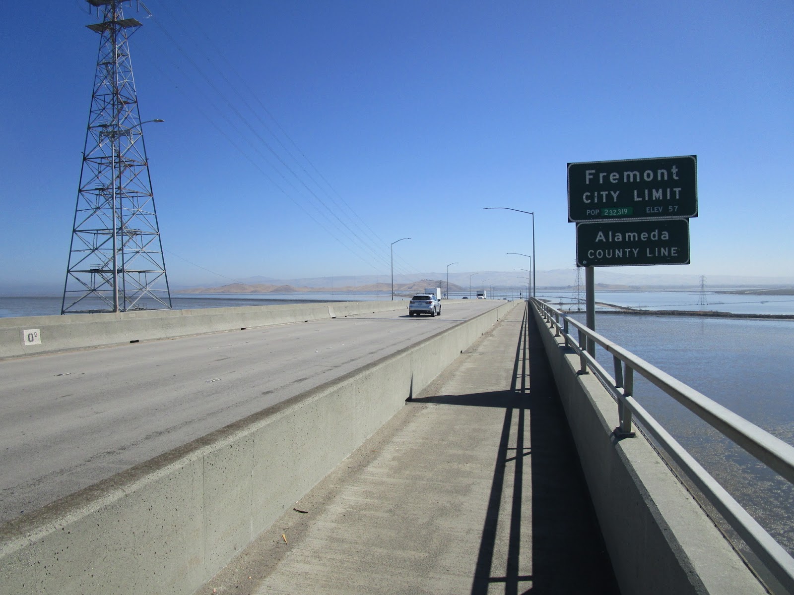
On some days you can see north to the Dumbarton Bridge - not a super clear photo, but an interesting landmark if you have visibility:

A better view on a different day:

Moffett Field to the south:

Plenty of shorebirds, including pelicans:

I believe this might be a golden eagle:

The final long stretch out in the middle of nowhere:

Hang a left at Stevens Creek (sometimes there is a porta-potty here, but don't count on it):

Cross this bridge (the first one you come to) over Stevens Creek:

There are a couple quick turns through here - all have signs but it helps to be ready for this section. Left off the bridge (and back onto pavement):

Quick right turn:

And another quick right turn to go north (the whole time staying on the Bay Trail):

The dip across the north end of the canal:

Looking back at that spot; a split to watch for if you're going in the counterclockwise direction:

The Bay Trail comes out to follow Shoreline Blvd briefly:

Heading toward Shoreline Lake Park:

Pretty little bridge crossing Mountain View Slough:

Following the Bay Trail to the right:

And through some lovely trees:

Another right turn to stay on the Bay Trail:

About to curve left to follow alongside the Bay again:
Stay along the Bay; don't take any of the paths going inland toward the lake. Stay to the right here:

Aiming for the little building on the left:

Here is a photo next to that building. This intersection could really use a sign. You want to head inland on the Adobe Creek Loop Trail. It's the one on the right in this photo. Be careful at this spot, it's easy to mess up, and there is no indication that the Bay Trail continues in that direction:

Approaching highway 101:

Turn right to parallel Bayshore Road and the 101:

Best sculpture on the route - Bike Man!

Eventually the trail will veer away from Bayshore Road, but don't do that. Continue straight onto Bayshore:

At Embarcadero, jog right/left onto Geng. Here's Geng, with previous detour signs up ahead (the detour should be gone now, as of Feb 2019):

There is a bathroom (with running water) at Baylands Athletic Center at the end of Geng.
From there, jump on the San Francisquito Creek Trail, to the right - heading north.

Cross the creek on Friendship Bridge:

Continue to follow the creek trail going north. Look for this S-turn in the trail:

Don't exit the trail quite yet, go north just a bit more (past a field) and then look for the exit onto Weeks Street:

Weeks ends at Cooley; go right (north) on Cooley. Cooley quickly ends at University Avenue; turn right to continue north.
University crossing over Bay Road:

Bay Trail sign on University:

The top end of University; turn right onto 84 toward Dumbarton Bridge (mostly used by cyclists, but occasionally I'll see another runner on the path):

The next long, straight section, except not as serene as the part near Moffett:

Just before the bridge, cross over the road to stay on the bike path (otherwise you'll hit the parking lot, and if so, just go up the stairs instead):

The whole point of this FKT loop - time to enjoy a unique experience running over the long bridge:

Plenty of scenery to the south:

Switching towns - and counties:
And coming down off the bridge and onto Marshlands Road. Don't get too excited, it's still a long way to the other side of the Bay (at least the traffic isn't quite as loud over here):

Finally reaching Don Edwards wildlife refuge, and one of the only hills on the loop besides the bridge:

An excellent visitor center, with a shady picnic table:

Also a trash can, water fountain, and bathrooms that are usually open:

A marsh along Marshlands Rd:

Marshlands ends at Thornton; go right here, or better yet, go through the new parking lot that cuts off this corner:

Thornton has some nice shady sections on the way into Newark:

There are convenience stores and restaurants in Newark if you want something more than the Don Edwards water fountain. There isn't much else for the next several miles, FYI.
Turning right (south) onto Cherry Street:

Hey, a random Bay Trail sign:

Sportsfield Park (on the right just after Mowry) might have a water fountain, but I've never crossed over to check. I like running down the east side of Cherry (which becomes Boyce and then Cushing); there are only a couple short sections without a sidewalk and those are still pretty easily runnable. Cross back and forth if you prefer to stay on sidewalks.
Nice section of lawn and trees:

There tend to be many pretty flowers along the east side of the street, different colors depending on the season (and the Bay Area does have seasons, you just have to look for them):

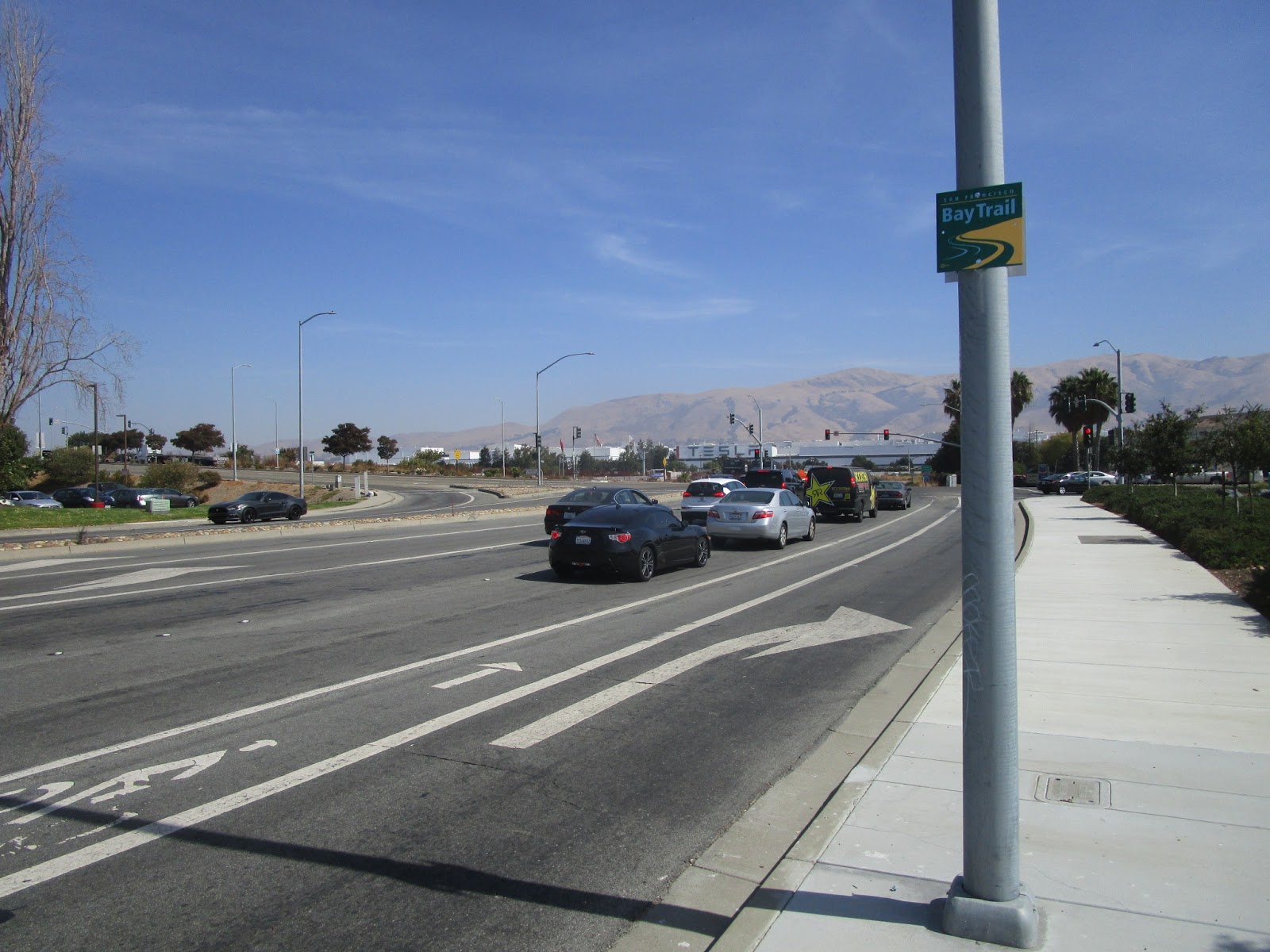
Cushing is about to end at I-880; a couple notable landmarks are Mission Peak on the horizon and the Tesla factory across the highway:
I always stop in at the Chevron on the other side of Fremont Blvd; they have a good bathroom and (surprising) water fountains:

And a funny sign - the small text says "If you are caught you will have to mop the floor"

Continuing south on Fremont Ave:

This section can either be pleasant or a really long way if it's a hot day and nearing the end of your loop. A bit of bike path toward the southern end:

Cross Dixon Landing onto McCarthy Blvd. You're looking for a turn to the right onto Coyote Creek Trail, just past this sign:

The start of the last bike path section:

After a couple miles, the path follows Alviso Milpitas Road briefly:

The bike path ends at this gate; continue instead on the road parallel to 237:

The road dead-ends but the bike path picks up again:

Up a slight hill to Zanker Rd:

Street art is for the birds:

Left on Zanker and across 237:

Take the first right onto Holger Way - almost there!

And one more right turn to stay on Holder Way...

Back to the spot I started at that morning. It wasn't actually dark when I finished, I just don't have a daylight photo of this location without my face taking up half the picture... maybe next time!

Hmm, maybe this:

So that's the whole shebang. Message me if you have any questions. Hopefully this seems somewhat interesting to any ultra runners looking for a 36-mile run in this area :)