It was long! I've never run that many miles in one go before. So this report is likely to also be long. I'll try to focus on the more interesting (at least to me) details. And anyway, I don't have a ton of time to be putting this report together, so some abbreviation is necessary if I'm going to post it in a somewhat timely manner.
Update - apparently I'm not physically capable of abbreviating a race/run report. So now it's long AND late. C'est la vie!
I've been thinking about the Foothills Trail for some time, even though it has only passed in and out of my upper consciousness at infrequent intervals. I believe we first discovered it when we climbed
Sassafras Mountain (highpoint of South Carolina) in 2014. I recall reading a sign that described the trail, at a not-scary length of 76 miles, but with a description of the 30-mile long Laurel Valley section that gave us pause. That's a long way to go in between roads or support.
More recently, I've been looking for an adventure that might extend my "longest run distance" which has been at 125 miles from the Big Dog Backyard in 2018. An FKT run seemed most logical, giving me a purpose for doing the miles while also giving me the flexibility to decide when, where, and how much distance. I suppose maybe someday I'll try a 200-mile race, but I have a hard time justifying the cost.
We found ourselves near Spartanburg in South Carolina and with a 4-day window for doing some extended training. Originally I was thinking I'd run every day at Paris Mountain (we had a campsite reservation set up). Then I did a run from Table Rock to Sassafras and back just to get a taste of the Foothills Trail, and while I was on the trail I started scheming for a way to fit in a yo-yo (out and back) attempt.
Yeah, maybe the weather wouldn't cooperate. Maybe my legs/knees/feet/"whatever feels like complaining now and then" wouldn't cooperate. Maybe it was a bigger adventure than I was ready for right now. But why not try and see? So I moved our campsite reservation to Table Rock and figured if nothing else we'd get to explore that area since there are a bunch of trails to choose from.
So in a way, I've been casually thinking about the Foothills Trail (FHT) for years, but the decision to actually run it was last-minute and only truly committed to a couple days beforehand. The one-way
FKT time might be beyond my reach (although now that I've seen the trail, maybe not). The out-and-back had been completed (and reported on) only once before, by Scott Hodukavich in 70 hours and 26 minutes. The female FKT was available.
There are a couple great resources for the trail, including the
Foothills Trail Ultra Runs website that tracks completions and the
Foothills Trail Conservancy (FTC). The FTC has an excellent map that I bought, also a nice step-by-step guidebook that I debated on but decided to forego.
An interesting puzzle - the parks on each end (Table Rock and Oconee) have closing hours, plus the summit of Sassafras recently got a rule added about not being there from an hour after sunset until an hour before sunrise. With the campsite reservation at Table Rock, we had the gate code, and John could always book a campsite at Oconee for a night to get the code there too, but I decided to make a solid attempt at being in both parks during daylight hours if possible. Sassafras Summit was a bit of a conundrum. It's 10 miles from Table Rock to Sassafras, and I had about 11 hours of daylight, meaning 13 hours when the summit is "open" each day this time of year.
To top it off, the Foothills Trail Ultra Runs website only recognizes an out-and-back if it is completed in under 72 hours. There are no such limitations to an official FKT run, but it sure would be nice to accomplish both if I could. I ran numbers for required mph paces, and it seemed like I should be able to do it, assuming no major issues or super-challenging trail. So my first goal was to complete the 152 miles, #2 goal was to do it in less than 72 hours, and I didn't think any further than that.
I set my start time at 12 noon on Saturday from Table Rock. The first pass over Sassafras would easily happen before nightfall. My first goal was to get to the other end at Oconee by dark on Sunday. I figured on an outgoing pace averaging 2.5-2.6 mph (including breaks), putting me there by sunset at 6 pm. That would give me good motivation to keep moving and then get turned around to start back.
My return pace was a super-lenient 1.9 mph estimate. We could work in a bit of sleep, hopefully, and I could do plenty of speed-hiking. There are a lot of hills to go over (and over) so that would slow me down but 2 mph should still be doable. Well actually, it would depend completely on the trail condition which I wouldn't know until I got out there. By the time I got to Oconee I would have a much better idea about that.
The final question was the return trip over Sassafras. Working backwards, I figured I'd need a maximum of ~5 hours from Sassafras back to Table Rock. One hour before sunrise is 6:25 am. Plus 5 hours = 11:25 am, with a bit of leeway for the 12 noon "cutoff" for the 72-hour goal. If I made it to Chimneytop Gap (the last obvious crew spot before the summit of Sassafras) early enough on the way back, I'd be happy to crawl in the back of the truck and sleep for a bit to wait for the summit to "open".
The one piece of info that I didn't bring along was Scott's time. Setting an overall FKT for a route that already has a male finish time on it is something I don't think I've ever done. That thought never crossed my mind, especially with the challenge of the Sassafras window at the end of a 3-day effort. I was completely focused on the 72-hour goal and figured it would be tight but was perhaps possible. And if that failed, just finishing would be plenty fine with me.
So anyway, it was a rather complicated plan, and it could all easily go to heck, but the spreadsheet ended up fairly clean and easy to understand (after I monkeyed with it for way too long). Let's see how this works out for us.
The noon start was really nice for finishing preparations. John helped me load supplies, set up the truck, gather food bags, all kinds of great pre-run assistance. I didn't feel like I was in a rush to complete everything, and I got great sleep the night before. More races should try this kind of timing!
I did get a bit antsy about getting going, but I had to keep the finish in mind. I couldn't start too soon or I'd be boxing myself in at the end. Calm down, make sure everything is ready, focus and breathe.
Hey wait! The InReach battery is at 56%, what the heck? I had just charged it. Somehow it had turned itself on, which isn't supposed to happen unless you hold the button down for a few seconds. Oh I see, now it turns on with just a brief button touch. And the "Lock" slider doesn't work to lock out the keys. Dang it. Well, I was already planning to hook it up to an external battery for the first section anyway, to keep it charged up before starting the Laurel Valley section. Of all the times to have a low InReach battery at the start, this was the best time. The battery charged it up to 100% by the time I started Laurel Valley, happily that plan worked. And I was really careful with the InReach so as not to touch buttons accidentally. Maybe it's time for an InReach Mini...
OK, I need to back up just one day and mention something interesting. The weather window somehow worked out PERFECTLY. I have no idea how that happened, but I certainly wasn't passing up this opportunity. However! We drove up to the park on Friday and it was snowing. Yep, big fluffy flakes of the white stuff. Not so much that it stuck, but it sure was pretty. And eyebrow-raising.
Anyway, Saturday morning was beautiful, sunny, still chilly but at least it would be the coldest day of the next 3. The night would be near freezing, but the following days and nights would get warmer. No precipitation (snow or otherwise) until Tuesday sometime. If I had to finish the last few hours in the rain, no problem.
Well, enough of the lead-in! So much for abbreviation, and I haven't even gotten to the photos yet.
First photo! Ready and raring to go from the Table Rock trailhead. Let's get this show on the road!
I scurried up the trail, excited to be moving and for some reason really, really happy. I mused on how various parts of my brain were all aligned at the moment. The primitive and higher mind had the same motivation, go explore! Go do this thing! Enjoy the day! Obviously that harmony wouldn't last the whole 3 days. Eventually the higher mind would need to have some discussions with the primitive mind about the "why" and the feasibility of this endeavor. But that could wait until later. For now, yay!
Lots of people on the trail - no surprise, it was a lovely Saturday afternoon. I didn't expect to see many hikers once I left Table Rock, so I didn't mind working around people on the trail. Hello everyone! Isn't it a beautiful day? I think those were more my internal thoughts and not so much expressed out loud.
The white Foothills marking, plus a yellow and green trail within Table Rock - seems like it should represent a country flag, but it's not quite Ireland. Mostly it means I'm going the right way.
The excellent boardwalk along the creek:
Making progress! However, I really need to put the camera away or I'm going to have WAY too many pictures to go through later!
OK, one more photo. The creek and rocks sure are pretty through here.
I had decided to switch to a fresh new pair of shoes instead of trying to extend the life of my current pair. That turned out to be a great decision. My feet were comfortable and happy, almost floating. Perhaps I should do that more often...
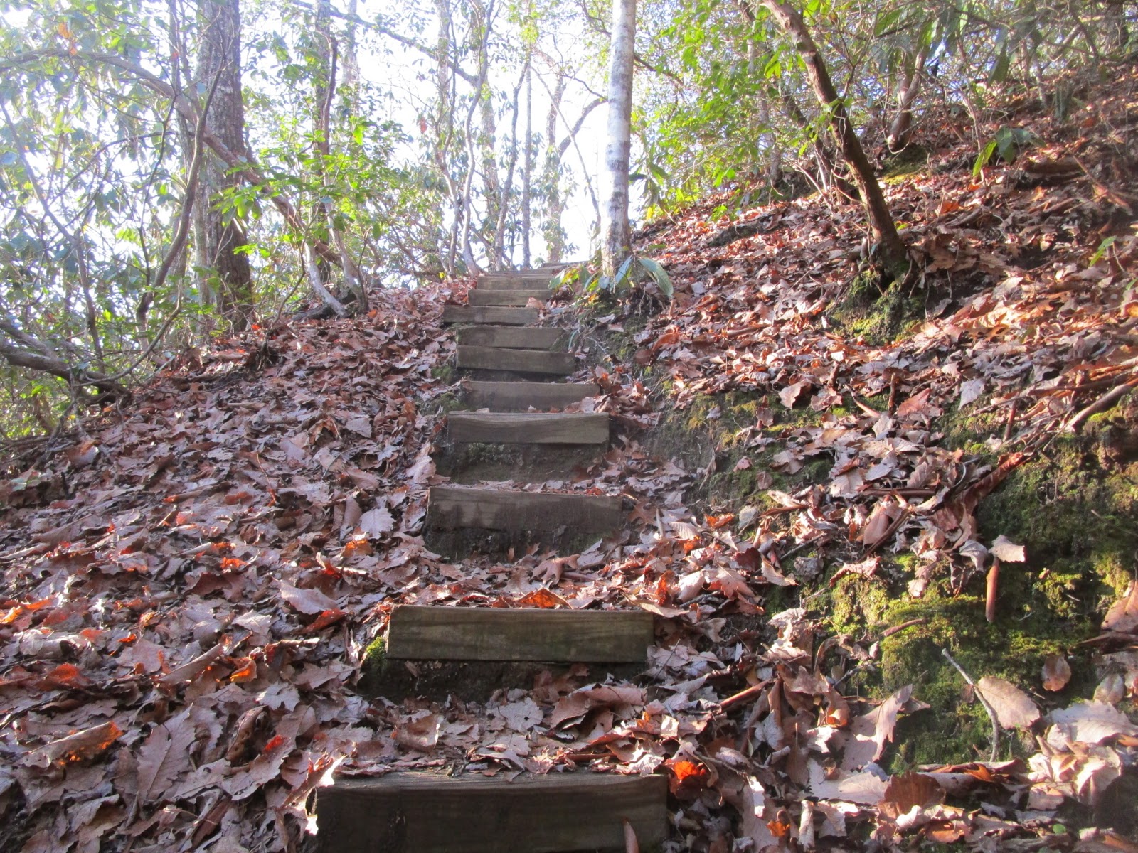
An excellent (and recently-made) little set of stairs. At this point I haven't seen too many stairs (yet).
Bit of a view back toward Table Rock. Someday we'll come back and hike up and over in this park. Looks like a great place to explore.
Shower Rocks, where you have to scramble to avoid getting dripped on:
2.5 miles, and I better not start doing math in my head anytime soon!
I briefly considered that this log might be the best way to cross the creek and then quickly belayed that. There's an easier spot to the left, over rocks/through vegetation and with better handholds.
Bald Knob! Perhaps the most picturesque place of the entire Foothills Trail. This puppy wanted to come say Hi but wasn't given permission. Good dog!
Very pretty. There was a slight smattering of rain from the dark clouds, but it was brief. Apparently John got more rain down below. Happily, all the clouds cleared out by the time I got to the start of Laurel Valley (and the forecast was for clear skies overnight) so I didn't feel the need to lug along a rain jacket.
And one more for good measure, since the camera was out already:
There were quite a few blowdowns along the entire length of the trail, but they're spread out, mostly easy to go around/over/under, and didn't feel like a nuisance. The FTC has a form to submit info about places that need maintenance, and I originally intended to document as many as I could. So I started with this one. And quickly gave up, too many to keep track of.
Climb, climb, climb... I made the turn away from the Pinnacle Mountain trail, meeting up with yet another set of hikers coming my direction. They would be the last people I'd see on the trail for quite some time.
Downhill, yay! I lightly tripped down the singletrack, pleased that I knew this section from my training run. Here's the nice campsite just outside Table Rock:
The cable across the slippery rock, much appreciated, and only slightly wet feet:
I was comfortable enough to put on the iPod and listen to podcasts for several miles. A few stairs, lots of leaves, a beautiful trail, and a happy runner.
I paused at the saddle for a quick snack/pee break and then continued on.
Trekking down to a cute little bridge:
Snow! The higher elevations around 3000 feet had not melted completely since yesterday's weather event.
I was quite fascinated by the snow, enough to take a few photos:
Such a beautiful trail through the laurel trees:
A look at the path leading to the next campsite, along with a couple mileage numbers for reference.
Maybe I will report this obstacle, I think it's relatively new:
At Sassafras... quite a bit earlier than my prediction for John. So it wasn't a huge surprise that he wasn't there yet. He was off exploring the town of Pickens. I texted him and then moved into the bathroom to work on my gear to keep from cooling down too much in the wind.
Of note, there are bathrooms at the following locations: Table Rock, Sassafras Mountain, Sloan Bridge, and Burrells.
Not long later, John drove up and apologized for not being there earlier - no worries! The cause was my estimate table that suggested I would take longer instead of basically bouncing up the mountain with excess energy. Plus, this is a multi-day effort, no sense in blaming anyone or focusing on anything but moving forward.
We swapped out my red pack for the vest for the run down the other side of the mountain. Then John walked up to the summit with me and we got a couple photos. Second time together at the
highest point in South Carolina! It's a really neat spot now compared to the bench in the woods from a few years ago.
Thank you John, see you again real soon!
I took pictures with most of the mileage signs (and occasionally referred back to them on the camera while I was running) but tried really hard to ignore the big number at the bottom - or even think about doubling anything! What's important = 4.7 miles to Laurel Valley, mostly downhill, I can do that.
Especially since much of it was on super awesome trail like this:
As I made the first road crossing, I noted a parking pull-out spot that isn't specifically called out on the FHT map. Perhaps we could use it instead of Chimneytop Gap, if all goes to plan and I make it back here before the summit "opens" in the morning in a couple days. I can hope, at least!
Downhill, a bit of uphill, lots of descending. Some spots were actually quick steep little drops and I wondered how that would feel on the way back. This could be quite the haul back up the mountain! I should try to remember that for later...
The trail across the way:
The next campsite, and I'm pretty sure I've given up trying to use these mileages for any pace estimates by this point. Of note is the blue marker that apparently indicates that there is water available nearby, certainly helpful for anyone without crew support or resupply at road crossings.
Almost to the bottom and the road over to Laurel Valley! And it's not dark yet, bonus!
I was a bit anxious about getting going on the next long section, but needed to stop long enough to make sure I had everything. I had set aside two sets of "Laurel Valley" supplies and compiled everything in my larger green pack for the first night.
The main question was clothing, since it was going to be the coldest night of the 3 and probably close to freezing temperatures by morning. I put on my warmest wool top, my best thick Amfib tights, and brought along a thin hoody, softshell jacket (also with hood), fluffy hat, and Blegg mitt gloves. I also brought some overmitts and another pair of gloves (wool) since the Blegg mitts were untested in something of this length.
All the standard gear (InReach, camera, phone, maps, little med kit, lights), 3 servings of Spiz, some snacks, a Camelbak bottle with inline filter, Sawyers water treatment mini-filter (for Spiz water), a small battery pack, an mp3 player, emergency bivy, and some assorted safety items including a compass... amazingly it didn't seem too heavy or bulky. I fiddled with the front InReach pouch to get it comfortable but otherwise everything rode fine.
Thank you John, I think I'm ready!
Hiking up the trail amid more laurel trees:
One quote I remember from someone else's Foothills Trail report - "This place has more stairs than a place with a lot of f'ing stairs" - so a sight like this was no surprise. I wasn't sure how my legs/knees would handle that many stairs, up AND down, so I took them carefully right from the start. I was also happy to have a trekking pole with me.
One of many little bridges as the trail weaved in and out of side drainages along the side of the hill. Much of the time, at least until the 3rd day, the wood tended to be slippery from frost so I was always very careful going across.
Another nice camping spot:
Heading for the drop down to the creek, and it started getting dark soon after I took this picture:
Nice long run down, with an occasional little climb that immediately went back down. I tried not to question the trail builders too much because they did a remarkable job with carving out a path along many a steep hillside. The trail is in amazing shape, well-built and well-supported at the edges, so a bit of up/down and some narrowness was easy to understand.
The FTC website mentioned a bridge that was out and a marked detour, so I was on the lookout for signs as I reached the creek. This yellow sign wasn't large and it was low to the ground, but it was easy to spot if you were looking for it. I followed the detour arrow to the right, glad to have figured that out without needing to backtrack.
The detour was on a small, old road, a bit muddy in places but otherwise easy running. It took me to the next reentrant over and then down to the main creek. Partway down I took a short break, sat on a log, drank some Spiz, and put on the hoody and fluffy hat.
At the return to the normal trail I paused to study the spot for the way back - I really didn't want to miss it at that point, and it was likely to be dark here again (if plans worked out).
So I didn't get to see Virginia Hawkins Falls or campsite, I guess I'll need to come back someday to check that out. No matter, there are plenty of other things to see. For now, I was following white blazes again.
And trying my best to stay on the correct path. The way down toward the lake looked so straightforward on the map, just follow the creek. However, the trail would follow a dirt road for a bit and then veer off. The road would ford the creek while the trail took a turn to go over a bridge. Trail - bridge - road - quick turn - trail - bridge - more road - another bridge - more trail - back and forth across the creek. I lost count of the number of times I crossed the creek, maybe 8 or 10? Amazingly, I stayed focused and eagle-eyed and didn't miss any of the turns.
After what seemed like a long, long way, I saw Laurel Fork Falls across the way and soon came upon the sign for Laurel Fork boat access (the side trail to the lake):
From there the trail wound gently upward on a wide, easy-to-follow road. I hoped I might be able to run this downhill in the other direction. I marveled at the lack of spiderwebs, poison oak/ivy, bugs of any kind. And the perfect weather. I could not have asked for better conditions. I should try to make the most of this!
There were a few little intersections, on and off a small road, and the blazes continued to be obvious as long as I was looking up. Thankfully I didn't need to stare at my feet since there weren't many trip hazards.
The map had me generally going around a large drainage area, high above the lake. Oddly, I could see lights in various places in the distance. People? Houses? I wondered if I might meet another runner on the trail also doing a long trek, but nope.
I watched closely for landmarks - a little creek crossing, a big uphill with wide steps, a turn with a less-than-obvious sign (make a note). Then there was a steep downhill set of stairs that popped out on a road and I did not see clear markings to get me back up those stairs for the return trip. I stopped and studied this spot very carefully, really not wanting to miss those stairs later.
Then a steep-ish drop down toward the lake and the entrance to Gorges State Park - and I'm now in North Carolina!
I criss-crossed back and forth between the Carolinas several times but never knew which one I was in without looking at the map. That was pretty funny.
The trails right around the Rock Creek crossing aren't super well marked, but with a "pause and look around" approach I found the path on the other side without too much delay.
And then I was on Heartbreak Ridge! I had heard about this one. It climbs a few sets of stairs like this one:
and follows atop a narrow ridge. I could hear Rock Creek on one side and knew the lake was somewhere on the other. Very cool in the dark. Each time I topped a set of stairs I wondered if that was it? That wasn't so bad. Oh, there's another one. Hence the name.
Eventually there was a turn down onto a steep stairway, THAT'S the top. I took the downhill stairs very carefully. And made a note of the famous bench on the way down:
Passing the Toxaway camping area, I smelled and then saw a campfire, plus a couple of campers (well, I didn't actually smell them, just saw them hanging a food bag). Just cruising on through, don't mind me!
The bridges over Toxaway Creek and River are quite impressive. Some people put in a lot of work to make this trail! The mileage sign on the other side:
Then there was a big staircase up, followed by more stairs except going down. Trying really hard not to complain about these seemingly-unnecessary elevation changes (see above re: all the work that went into this trail!)
I did a little bit of math at that point, starting to work out when I might arrive at the intersection near Bad Creek (point A7a on the map). John was planning to hike in to meet me there, 3 miles before the Whitewater parking lot. I'd told him that it was OK if he missed me and we made a plan so he would know if I had already come through. I also figured I'd try to text him with an ETA if I could.
So anyway, 19.3 miles to Whitewater, minus 3 should be 16.3 miles. I won't go into great detail about the calculations for the rest of this section, but I will say that I got really curious about how I could always have more miles remaining than the numbers suggested per the signs I saw. A couple possible suggestions - my brain wasn't quite as sharp as I thought it was at the time; and I'm not precisely sure where the "Whitewater" location was according to the trail signs. Maybe not the parking lot; that might explain some of the discrepancy. Or maybe it was just my brain being slow.
No matter! Just keep on moving. And paying attention to the blazes. The next long section spent a lot of time on doubletrack roads. Great for running, easy footing, but I had many moments of concern when I realized I hadn't been watching closely enough. Did I miss a turn-off onto a trail? Because there were some of those. Thankfully I caught them all, and the double "turn turn" blazes shown bright white in my flashlight beam. Whenever I wasn't sure, I started pace counting and always saw another blaze before I got to 100. Some blazes were old and worn, but still in the distinctive rectangular shape and mostly easy to tell apart from rounder mossy/lichen patches of white.
I needed to refill water not long past the Canebrake boat access point and made a plan to stop at one of the creek crossings on the way up the steep, steep road. Partway up the hill there was a perfect spot - easy access to the little creek, right next to a footbridge.
I worked out a system using the Camelbak bottle and the Sawyers bag/filter to squeeze clean water directly into a Spiz baggie. Carefully close that up... then I filled the bottle again, attached the cap with its own filter inside, and I was ready to go with a full serving of food plus fresh water to drink. Expedition adventure racing sure comes in handy sometimes. Not just for logistics either, it helped me later with the experience of multi-day racing to draw from. But anyway, that's getting ahead of myself.
I'd brought along an mp3 player but never considered using it during the first pass through Laurel Valley. Too much else to focus on, and I was super alert about staying on the right path.
At various points in the run, I thought back to a recent meditation session where the topic was the body. For anything physical that draws your attention, focus on it, move toward it, see what happens. I tried this for any small niggle that popped up, little sensations in my feet, knees, IT band, various parts of my legs. Every time, at least for the first 24 hours, when I focused on it the "complaint" magically drifted away. Nice trick! That seems especially useful when trying to determine whether something might need actual attention vs. things that can be noted for future reference.
Lots of running on the old roads. A few trails off and on. Finding the Bear Gap camping area, and thinking I should be looking for a waterfalls? But the trail just went up the hill with no particular sign of anything interesting around. Oh right! That will happen at Bearcamp Creek. Two bears, not confusing AT ALL.
I believe this section is where the trail came out on a road at an intersection. Hmm, which way to go? No sign... oh! There's the trail, up some stairs over to the right. Got it. Most of the time when I wasn't sure, standing and looking around answered the question.
Occasionally there was a "turn turn" double blaze but the actual trail went straight (instead of taking a side trail), so that was a bit confusing, but usually I could see the next blaze from that spot so it wasn't too difficult to figure out.
Narrow, winding trail, then a long descent. I moved efficiently but didn't run much of it because the trail was twisty and thin. No sense in taking any chances here.
Down a bunch of stairs, then finally to the Horsepasture bridge:
The river sounded loud, or maybe it had just been so quiet the rest of the time. I looked forward to seeing this section in the daylight, I hoped.
I believe I was back on a wide road after this, and somewhere in here I somehow managed to spot this sign in the dark - halfway to halfway!
I honestly couldn't put that location precisely on a map, but it sparked my brain to try again with "mileage math". Still more confusion on that subject, probably a memory error in my numbers, just keep moving.
OK, now THAT is Bearcamp Creek, then a climb on a small trail, then some slightly confusing markings but I eventually found the sign that pointed toward the detour to Hilliard Falls. Maybe next time, waterfall!
Climb, climb, gate and a road crossing, more trail, climb, climb. Eventually I found the sign for Coley Creek and decided it was well about time to get out my next piece of map. Then maybe I could finally estimate just how many miles to go before potentially seeing John!
Ah ha, OK, it's not super far, but it's also not just right around the corner. I decided to wait until the next large creek crossing and then text him that I was about an hour away. Finally, a plan!
Well, that next creek crossing was perhaps the most confusing spot of the trail. You come down to the creek, which you can hear. But you can't see the bridge (at least in the dark I couldn't). It feels like the trail goes left along the water. But that just dumps you into a camping area with no obvious markings or trail exit. Back to the first spot, maybe over by that wire fence? Yes! There's the bridge. All the other bridges on the route were a lot easier to find!
Over on the other side, it also wasn't super clear. I actually tried one direction, came back after not seeing any blazes, then decided my first instinct must have been right. That was correct, through the boulders and then eventually there's a blaze.
Texting John on the InReach, maybe he'll get the message. If not, no worries.
The last couple miles went great, faster than expected, nice trail and good footing. Although, the closer I got to "civilization", the more worn down the dirt was and the more the laurel roots stick out. Still, not bad.
And there's a headlamp and it's John, yay!!
I sat for a couple minutes as we swapped my pack for a vest. It was getting just a bit chilly so John pulled out the softshell jacket for me to put on:
It was a relief to finish the long 30-mile section, to find John, and to have a lighter load with easy crew access for quite some time into the future. And I was still moving great, plenty early vs. my estimated times. It was nice having leeway.
The short section through the Whitewater area was slow. I took it easy on the wooden bridges and stairs (slippery!), the footing was a bit challenging in places, and it was generally uphill. I could hear all the cascades, in the main river and the side creeks, very impressive. It would be awesome to see this in the daylight.
The bridge over the main river was interesting. First, climbing up on a large boulder just to get to the bridge. Then on the other side, a big step down onto another huge rock. And... what next? I could see a blaze on a tree right over there but it wasn't clear how to get to it.
Step across to the big rock to the right? Hmm, not sure how that would help. What about going down the boulder that I'm standing on? That seemed most feasible. I worked my way down, then used rocks and large downed trees to get to the shore. It was all shallow water below me, nothing worrisome, just quite surprising that suddenly I was picking my way when the whole rest of the route was so obvious.
Through some rocks and there was the trail again. Phew, no problem. One big climb up the side of the hill on switchbacks and I found this sign:
Ah ha! This is probably the spot called "Whitewater Falls" on the mileage sign back at Toxaway Bridge. That explains at least part of my math perplexion. The rest was just a brain fart, enough about that topic please.
The 0.8 mile trek to the highway was slightly frustrating, probably in some part because of the slowness in the prior 2 miles getting up to that point. Undulations, stairs, and a lit-up bathroom that was out of the way and UP THE HILL from the Foothills Trail proper - teasing me but not enough of a temptation to make the detour.
Finally, I was almo...no wait, one more downhill (why??) and then a haul up one last climb and I was now finally to the parking lot. And John, yay! Phew, glad to get that section out of the way.
Either here or at one of the following parking lots, the following things took place:
1. My right foot was feeling a tiny bit of PF pull, which had been a problem a couple years ago so I was ultra sensitive to it. It seemed really minor, but I knew better than to ignore it. Especially when there's an easy fix. John put a long piece of Leukotape across the bottom of my foot while I flexed it. In the miles immediately following, I felt the foot stretch out nicely and then everything went back to normal. And I slept with the foot boot for a couple nights following the run, just to be sure. I love problems that are so easily resolved! If only I had such an easy answer for my IT band problem.
While we were doing that, a sock change and some fresh RunGoo seemed in order. My feet were doing great, maybe I could keep them happy for a while longer.
2. I asked John for 10 minutes of sitting with my eyes closed. I didn't sleep, but it was a nice rest for my eyes, along with the rest of my body.
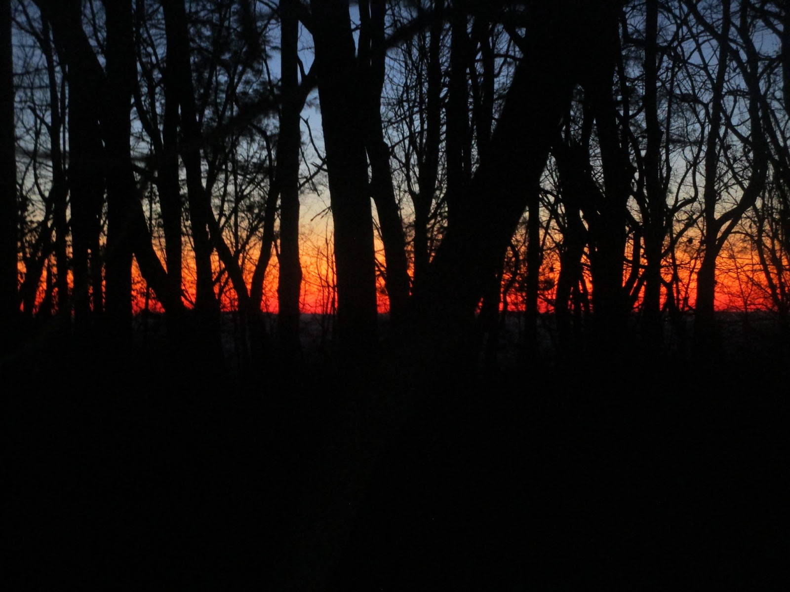
I glanced at the map - oh, more climbing. OK, let's do it. Up some switchbacks to a ridge where there were a couple benches but nothing yet to see in the darkness. Working my way around Round Mountain, I was lucky to hit the next narrow ridge as a gorgeous pre-sunrise glow became visible through the trees. No bench to sit on, but I did stop briefly to try to capture a small bit of the essence:
Just as I felt the need to pull out the map to see where I might be, I saw the road down below. Then the truck and John, hello again!
John had set up the passenger seat of the truck with little snacks on the dashboard, a "bento box" with a variety of food pieces, options for bars and things to carry with me, a towel on the seat to sit on, Spiz in a bottle to drink. I could survey the scene and pick out whatever looked good, while he refilled my water bottle and helped with whatever other things I needed. Super Crew on the job again!
I thought I would still need my flashlight when I left Sloan Bridge, but John said I could get away without a light. Hmm. I used the bathroom (yay bathroom!) and when I came out I could see plenty fine. Yep, done with the lights for now!
Heading out on the next section, 3.3 miles along a creek. I looked back to see John taking a picture so I took one too. Thank you John!
The trail was a bit slow and slightly muddy in spots. I got occasional views of the creek I was following:
I happened to look over at one of the side creeks and noticed a super-tall waterfall dropping down from above. Very cool, but impossible to show the impressiveness in a photograph amid the laurel leaves.
The trail improved but also started climbing, then there was a waterway on my left. I was curious about the topography but not enough to get the map out to study it.
More climbing, up to a saddle and the Fish Hatchery parking lot. Still making great time, still happy. And it looks like John has been heating up water, excellent. Warm Spiz is especially yummy.
Ready for a water refill:
The day was warming up and a couple of clothes were coming off:
I really appreciated being able to run with the vest for a while instead of toting a pack. Supported running rocks!
Running downhill also rocks! Except for a slight climb partway in, the next section was a long, flowing, smooth downhill glide. Fun! And a good hill to remember for the way back.
I pulled out the camera once for a quick series of photos.
Hills in the distance:
An example of a "turn turn" blaze, at an intersection with a side trail:
And the lovely trail I was running down:
Even faster than expected, I was at the road at the bottom. Hey, this is a National Scenic Trail, cool:
An example of one of the snack arrays:
I was actually prioritizing salty foods, and probably shouldn't have brought so many sweet ones along. Cheesy bites and cheese crackers really hit the spot. Also some miso broth, which I should have brought more of (I forgot to get the Trader Joe's ginger miso that had worked so well at Big Dog). And John surprised me with some macadamia nuts he had discovered at a local grocery store! Those might have been more for him, but I took to them and probably ate more than my share.
But I couldn't resist an occasional maple candy or mint dark chocolate Tim Tam!
OK, next! The one other large-ish section, 10 miles along the Chatooga River. We set up my smaller pack with some supplies and off I went to go explore. And it's iPod time! Fittingly, I started with an episode of the Fastest Known Podcast. I always enjoy listening to Buzz, especially when I'm actually running an FKT attempt.
The river was gorgeous. I was so happy to get to see it in the daylight, at least this time through. In fact, I had to balance gawking at the scenery with paying attention to my footing. To take pictures I would come to a complete stop, so again, trying to justify a few photos while keeping in mind that I'm on the clock.
Fisherman in the river on a pretty morning:
This place made me particularly happy:
The cascades are so neat, with interesting rock ledges made of shapes and colors that I hadn't seen before. I think I read that Deliverance was filmed in this area.
My nose was slightly bloody, probably from the colder air overnight. It was nothing major but I normally only see that at higher elevations.
I had one funny moment of looking across the river and realizing, hey, that's Georgia over there.
Armadillo! I tried to get a photo but he was shy, and quick. I followed a parallel path until he burrowed into a hole in the side of a ditch. Unexpected animal sightings are (usually) fun.
There are lots of ups and downs along the river, and it took longer than expected to get to the big up and then back down. Overall, this section was slower going and more technical, but also so pretty!
I spent the time listening to a podcast from Ezra Klein's climate change series and then Erin MacDonald's "Science of Sci Fi" book. Focusing on technical and yet entertaining chapters helped pass the miles. So much to think about.
Finally I was over to the side creek and away from the river.
People! Around the Nicholson Ford section I saw the most hikers except for at Table Rock the day before. Day hikers, kids, dogs. I think I mostly cleaned the snot/blood off my nose and was generally presentable...
Just a bit more distance until I see John again:
I was still climbing OK but wondered how much I might slow down. For now I was making acceptable time and beating my estimates with enough time for a break to start ahead of the time targets.
Soon I was at the highway crossing at Cheohee Road. John reported on his texts with Dave - I told him to tell Dave that I was expecting a hotel room because it's night 2 (see our
Cowboy Tough expedition race experience). John said that Tug (our truck) will have to do. Indeed, I think it will do quite well. Now to see how far I can get before I need to take John up on that.
This is perhaps the stop where I proudly showed John my bloody snot booger. Hmm, I don't think John was as impressed with it as I was.
Snack time, and now that I see that my shoes were off I'm thinking this is where John taped my foot as PF prevention:
Moving on, I circled around Dodge Mountain and then started a fun, fast downhill run. John had pulled into the Jumping Branch parking lot to see if I needed anything, but all I needed was a high-five as I passed by. Thanks John!
The run down to Tamassee Creek was really pretty, lots of laurel trees and running water. Then a climb. And more climb. And more uphill. I'm not to the end yet!
Just past the towers I could run again, downhill toward Oconee. Except! There was this blowdown that was super awkward, two large tree trunks at the worst spacing. Too low to the ground to go under, too high to go over, too long to go around on the side of the steep hill. The only option left was to go between them, so I squeezed myself through. Not looking forward to doing that again!
OK, now I'm in the park. See?
Someone else had mentioned how the trail winds this way and that, and you just want to be done already. I thought they might be exaggerating a bit. They're not. Multiple intersections and "where is the parking lot?" thoughts later and I finally found the sign, woo hoo!
Halfway done - but don't think too hard about that!
I did a quick resupply at the truck (what, no bathroom?) and John took my picture before I started off again:
I was stoked to make it there before dark (at about 28 hours), one of my main goals. The pace chart switches to a lower mph estimate after this point, giving me easier targets to hit that hopefully would account for some slowdown.
On the other hand, it's a climb to get out of Oconee Park, not to mention the climb after that. And after that. Basically, now that I knew what was ahead of me, I had to really, really not think about it in total. I had made my minimum "acceptable" mileage in getting to Oconee, but I was still far from an FKT.
So it took some mental motivation to get out of there and get moving again. The trick was to "just do it", especially since I didn't have any good reasons not to!
Yeah, don't pay attention to the bigger numbers on the sign:
Climbing up - here it is! See, this was a bit tricky, sliding over the bark. I can't imagine how backpackers get through here:
It really was great having an idea where I was now. I could start ticking off landmarks. Done with that hill, won't be seeing that tree again, what can I check off next?
John hiked down from Jumping Branch and accompanied me on the climb back up. It was fun getting a chance to talk more normally and not focus on a crew stop. He enjoyed the scenery and took photos.
I debated when to stop and sleep. I wanted 4 hours and I had time banked for it. Cheohee Road seemed a tad early (it was only just getting dark) and honestly I wanted to get the river section out of the way. At Burrell's earlier I had assessed it as "a good place for a sleep" so I decided to stick with that plan.
I told John I was dealing with a slight headache. Funnily enough, re-reading a bit of my Cowboy Tough race report I discovered I had the same issue on day 2 there. John and I wondered if I might be missing my decaf coffee? It has a little bit of caffeine, apparently my body/brain was feeling that absence. Jeepers, I can't imagine needing the real cuppa Joe every day.
Up at the highway crossing, John mixed me up a decaf Starbucks Via with some warm water. It was yummy, not sure it helped the headache, but it made me happy.
We dressed me up in warm clothes for another chilly night, same set as the first night. Lights, pack, provisions, not too much since it was "only" 10 miles to Burrell's.
OK then, on to the river!
It was starting to take some real determination to keep moving forward. Some combination of mental and physical fatigue, trying not to imagine the task ahead, and darkness. My primitive mind occasionally appeared with reasons for stopping. My higher mind reasserted itself and worked on fixing those things. Interestingly, thinking about my brain in this manner helped me step back and see the situation impassively (logically?).
All parts of my brain agreed that the only thing that mattered at the moment was moving reasonably well along the river and getting to Burrell's. Then "we" could sleep.
Erin MacDonald kept me entertained with scientific Star Trek and other Sci Fi topics. Warp drive, time travel, the fabric of space-time, all kinds of great concepts. Thank you Erin!
I finished her book and started The Martian. I'd seen the movie but had not read the book, and now Wil Wheaton was narrating it (bonus!). I plugged along the trail in the dark, noting places I had seen just recently in daylight. I wasn't stopping for much, and didn't pull out the camera again for a few hours. Just focused on getting to Burrell's, I guess!
I did pause once near the start of this section to put on more clothes. My hands were loving the Blegg mitts and they worked even with a trekking pole in one hand or the other. Later I stopped to drink Spiz, but for the most part I was gliding through the darkness and listening to a story about Mars.
Up a long hill, over and down to the river, near the water, up and away from it, a few more ups and downs. I occasionally noticed something I had seen before but it was more about plowing through, trying to make progress over the more technical stuff, being patient.
Once in a while the blazes weren't immediately obvious along the water and it was a bit challenging staying patient while trying to figure it out.
Where...is...the...end...of...this...section...need...sleep...
I stepped slightly wrong in one spot on a narrow piece of trail and ended up sliding off the trail. Upside-down somehow?? I found myself resting in some laurel bushes, kind of flailing, looking at the trail just above me. There was plenty to grab onto to get myself back upright, OK, what just happened? That'll wake you up! I verified that I still had the InReach in the pack and determined to watch my feet more carefully.
Not much further, I found the intersection to King Creek Falls, phew, almost there. Then, a headlamp over near the river - ? And maybe a tent? I see now that there's a campsite on the map in that area, but it sure confused me at the time. Like, why is John wandering in the woods instead of waiting at the truck and why isn't he even on the trail?
Yes, sleep is definitely in order! Finally, one little set of stairs and I was at the road. John, I made it. And I didn't even fall in the river.
He woke up from a nap, helped me get a few calories in, found me an ibuprofen (to hopefully get rid of that nagging little headache) and got me settled in a sleeping bag in the back of the truck. He wrapped my feet in a small blanket to keep them warm. Nice and cozy and comfortable. So appreciated, sweetheart!
I was out cold for 2 hours, woke up urgently needing the bathroom, then crashed for another 2 hours. It would have been blissful, if I had been aware enough to remember any of it.
As a side note, sleeping at a known spot in the middle of the night on Sunday made my weekly mileage calculation a whole lot easier :)
After 4 total hours, John woke me up - no more headache, yay. I called upon my expedition racing experience to get moving again, basically don't think about why or how, just focus on getting your stuff together and only commit to doing the one next thing. In this case, walking up a hill. That will warm me up, it's not very far, and I can be happy that I skipped some dark hours on the trail by sleeping in the middle of the night.
I didn't have a whole lot of motivation to get up and get moving, but it was what I was doing, and I accepted that. John helped me get my vest together, yay not much weight for the next several sections.
My legs seemed to be good for moving on, except as I walked up the hill my IT band kept tightening up. I stopped to touch my toes a few times and eventually everything stretched out and seemed back to normal.
Yep, still on the Foothills Trail!
The climb up from Burrell's was actually the perfect way to start the morning. Easy footing, just put one foot in front of the other, no issues with climbing, no need to do anything quickly. Slowly my mental fog cleared and it was a pleasant ascent.
Hi John, I made it to the top! We were both happy that the climb went well and we were ready to tackle the rest of the morning.
A selfie while sitting in the truck, for some reason:
It felt like I was getting back in gear, spinning up to a normal pace (both mentally and physically). I hoped to get back to my estimated times, having dropped back by almost an hour after the long rest. Happily, setting a low, low bar of 1.9 mph made me feel like I was doing so well. It always felt completely doable, with time to spare. My legs were always happy walking and I worked on speed-walking when I wasn't running. In general, as much as I could, I tried to be nice to my feet and legs.
I picked up a bit of speed down through the fish hatchery area, enjoying the nice trail. When it became somewhat technical I focused on my feet.
I found myself marveling at The Martian story (yes, I know it's fiction, but it's so well written) and finding inspiration in his problem solving. I can solve problems too. Also, it was quite motivational. I appreciate that in a good audio book.
Just like that, I was back at Sloan Bridge and back on schedule. I was just about to 100 miles, although I don't think I knew that at the time. Quick pit stop (or at least, I'd like to think it was quick), and I was on my way again.
Another climb, happy that my legs are still OK with this. Nothing fast, but consistent.
Sunrise near Round Mountain again! I'm so lucky - this is a great place to see the first light of day. South (and North) Carolina has some of the prettiest sunrises and sunsets.
Feeling lucky:
An interesting rock caught my eye, some kind of conglomerate (maybe?) that seemed a bit out of place:
This looks like a great place to sit for a snack. Thank you, excellent bench:
The Martian book got pretty exciting while I was running through here, plus now I could easily see the trail, so before I knew it I was coming down to the Whitewater parking area. I turned off the book for a few minutes before arrival so I could focus on everything I needed at the truck and everything I wanted to tell John for the next section. He was going to hike in again at Bad Creek, but I wouldn't see the truck again until after the long Laurel Valley traverse.
Hello honey!
Lots to consider, most importantly what goes into my green pack. Oof, that is going to be a big bunch of clothes, food, gear... and the day promised to be warm, so most of the clothes were getting stuffed instead of worn. And I estimated several hours longer this time, so more food (which I'd already set aside in a "LV2" bag for this moment). Similar safety gear. Yep, this will be more of a hike.
Also, I had found plenty of water in Laurel Valley so I didn't need to carry much at a time (I just needed to remember where the creeks were). But we did preload one Spiz baggie plus my water bottle, to save time with treating water for the first portion of the "hike". 40 ounces of water to start.
But for 3 more miles I could still wear the vest, very grateful for that.
John reported that there was no rain in the forecast until Tuesday, excellent. I could at least forego the rain jacket. It was going to be warmer overnight, so I really should have foregone the softshell jacket too, that is the one big thing I would have changed about my packing.
So, John, I have a question. After checking all the papers on the seat, I didn't find anywhere that I had recorded Scott Hodukavich's time for his out-and-back run in 2012. Why didn't I have that number? I guess I didn't want to feel any pressure to try to beat it. Setting overall FKTs doesn't usually fall into the range of "plausible" for my abilities. Simply imagining finishing this thing was hard enough. John, if there's any chance you can find out that info, I'd be interested in it later.
One more thing (yep, this was a longer stop, in prep for a longer section) - my feet were still doing remarkably well, but it felt like another sock change couldn't hurt. John reapplied the RunGoo and a clean pair of socks, and my feet thanked him.
Finally! Let's get this show back on the road.
Back along the path, to the "Whitewater" sign above the gorge, and I'm excited to get to see this section in daylight:
Going down the switchbacks and checking out the bridge - wait, is that a ladder that I missed before? Hold on, let me get to the bottom...
Why yes, there is a ladder on the big boulder at the end of the bridge! In order to find this (in the dark) I would have needed to step from one big rock to another and then walk to the edge of it and look down. Too funny. Needless to say, this is the route I took going the other way (instead of scrambling over the rocks on the right side of the photo):
The falls were indeed special to look at - someday we'll come back and check out the side trails for a closer look at everything in this area:
Side creeks, bridges, ladders, lots of sounds and sights to take in:
I found John at the same spot as before, next to a nice big log I could sit on. It was going to be a quick exchange (vest for pack, move the InReach and camera) but as I double-checked a couple other things we realized that I hadn't made clear enough that I wanted one particular item moved between packs. Now I was missing my stash of tissues (i.e. toilet paper). Crap. That's probably the most fitting response.
Luckily we figured this out so I could scrounge a bit - a couple extra TP baggies from my bottle holder and orange jacket, OK, I can work with that. I've already experimented with using less paper for long outings in the mountains. Maybe I can tear the tissues into additional pieces. Maybe laurel leaves are non-toxic. OK, that last one is a stretch, hopefully it won't come to that.
Anyway, no worries. Well, except that this pack is stupid heavy, good thing I have a trekking pole to help me stand up:
See you in the morning! Thank you John!!
Another side trail to explore ... on another day:
My pace suffered a bit with the added weight, but I still managed a decent speed-walk and an occasional downhill jog. There was plenty of motivation to drink water and Spiz and to eat food! Although I wasn't all that interested in the food. Probably should have carried less. The warmer day made my mouth drier and my stomach less interested in digesting anything.
I met a couple backpackers who were trekking in the other direction. Now THAT's some actual weight to carry, I must stop my complaining. I wondered if they were the ones at Toxaway campsite 2 nights back but decided that would be too complicated of a question to ask. I didn't see too many people out backpacking on the trail, but it sure is a great place for it.
One of the first bridges in this section:
The second creek was again a slight challenge. At least finding the bridge was easy in this direction (and in daytime). Once across, the only way I knew to go left/uphill is that I remembered it from before. Otherwise I would have been wandering into the campsite area, again. This one spot could be greatly helped with one sign and more markings.
I couldn't remember the exact order of everything I would see going across this area (without pulling out the map), but I had a list in mind and decided to just be excited to check them off, whenever/wherever I found them. Here's the list (in the right order): Coley Creek, a gate, downhill to Hilliard Falls, along the creek down to Bearcamp Creek, the Horsepasture River Crossing, and Bear Gap Camp.
The big crossing of Horsepasture and the huge stair climb on the other side:
Looking at flat water underneath; I couldn't figure out why it had sounded so loud in the dark:
There was a lot of climbing up from the river. I was glad I didn't have to go back down nearly as far on the other side. This is probably one of the bridges on the way up:
And another amazing, beautiful bridge in the middle of nowhere:
I paused at Bear Gap camp to filter water, realizing that I needed to be more careful now since it was warm and I'd cause myself problems if I ran out of water for too long at a time. The camp has easy access to the creek, always appreciated.
My feet were starting to feel the effects of the added weight and the accumulation of miles. I normally try not to take any pills when I run, especially when I need to be monitoring all of my systems and solving problems quickly. However, I was sure I wasn't going to enjoy hours of foot pain, so I took an ibu and that dulled the ache enough to stop thinking about it for the most part.
The next few landmark locations were even more hazy in my mind, and there was even less reason to pull out the map to look because the trail turns into a weaving, meandering line through the middle of nothingness.
The one obvious spot, the powerline cut at the end of Grassy Ridge Road/Canebreak Trail:
I finished The Martian sometime in the afternoon and moved on to The Body by Bill Bryson. Fascinating subject, as all subjects are when Bill Bryson gets ahold of them.
It was neat seeing this part of the trail in the daytime and in the reverse direction. I mostly remembered/recognized it but sometimes it would look SO different as to surprise me. One rather steep climb, in particular, was something of an eye-opener.
A random shot of a tree on a rock:
Eventually I descended the steep downhill road toward the lake, saw the place where I first treated water Saturday night, and knew I wasn't far from the next major river crossing.
Yay for getting to see the lake up close finally!
And, oh right! The big set of up and then down stairs near the Toxaway River. Can't miss that.
Lucky to see the big bridge over the river while it's still light:
The river itself:
Only 5 miles to Laurel Fork Falls, I know where that is. I also knew there were a couple hefty climbs, plus some blazes I really didn't want to miss along the way.
Toxaway Creek just around the corner:
What a sunset!
The camping area was deserted this time, so I had my choice of benches. I admired the beautiful colors over the lake, drank some Spiz, and probably put on a layer or two of clothes. The warmth of the day was rapidly leaving, back to the comfort of running in chilly air.
I turned on another Ezra Klein podcast episode and set off toward Heartbreak Ridge.
So...this was an interesting 5 miles. It started with an uphill climb that seemed pretty minor in the grand scheme of things. What really kicked off the next chain of events was that I totally didn't see the famous bench on the way up. Yes, it was dark, but I went right around it without noticing. I also didn't think much about the stairs at the top of the climb.
In my memory, when I descended Heartbreak Ridge a couple days prior, the steps down were steep and tall and I had to be careful with them. I remembered the bench being super obvious.
So when I didn't see any of that in this direction, my brain jumped to "huh, there must be a third climb here that I don't remember."
Right. Because that's the obvious answer! At least for a sleep-deprived brain, apparently. This is what teammates are for during expedition races, to help when one of you makes a silly mistake like that.
Happily, the blazes were bright and obvious, and my brain was totally programmed to follow them. Across the "mystery ridge" and down the other side on the stairs through the leaves. A couple hard-to-spot blazes later and I was crossing Rock Creek. Still thinking that Heartbreak Ridge was ahead of me.
You'd think I might have pulled out the map at this point to correct myself, but no, that seemed like too much trouble.
I grabbed some water from the creek since it was easy to get to and I was at least aware enough to know I was about to go uphill again. Maybe more than once!
OK, now to climb Heartbreak Ridge and look for the bench...
I recognized the sign at the edge of Gorges State Park, yep, still going the right way:
Climbing and climbing, where is that dang bench and those steep stairs? Whatever, the blazes are leading the way, now crossing a road, weaving a bit, making a couple turns, going up some stairs, following a sign to the right, and I'm happily listening to my podcast and following white paint marks through the woods.
Eventually the podcast ends. And I'm on this old road that goes on and on. Shouldn't I be making faster progress than this? I know it's uphill, but come on. Slowly it dawns on me that I'm not exactly sure where I am. Is it possible that there is another set of white blazes out in the middle of nowhere? I started to get a little freaked out.
I pulled out the map. AHA!!! OK, that first climb was Heartbreak Ridge, I just missed the bench. And now I'm in the second, much bigger, climb. Come on brain, keep up.
Just to be absolutely sure, I also pulled out my phone and checked my location vs. the stars I had preloaded onto Google Maps. I didn't have reception for a detailed analysis, but I could verify that yes, I was in between two stars on my route. It was worth carrying the phone for that, if nothing else.
Phew, OK, stop looking for the bench. Now I really need to be looking for that turn that I was afraid I might miss.
On and on up the old road. Then it topped out, crossed an actual road, and I realized that I had previously made a note of the one spot where the trail goes away from the lake (otherwise it circles a large drainage, staying on the lake side whenever there's an intersection). But shouldn't that be after the confusing spot that I'm looking for?
Gradually the trail descended and I was happy to be able to run. Wait, is this the part that I was hoping to be able to run? But shouldn't that be after the confusing spot too?
All the things I had seen in the past hour or so flashed through my mind. The little stairs, the road crossings, the turn, a small downhill that I expected to be much bigger... I had been easily following the markings, thank goodness, but without checking off the boxes I had been saving for the way back. Wow. Wow.
It occurred to me that I might be experiencing something Erin Macdonald talked about, a shifting in the perception of time. Weird. On the bright side, I was making great progress and all the adrenaline was making it an easy effort! I might pay for this later...
Strange nav brain gone haywire. Thank you, blaze-following subconscious for keeping me on track. Note to self - maybe not listen to the iPod on night 3 when I'm supposed to be paying attention.
The downhill went on for a while, then *finally* I found the sign for Laurel Fork boat access. Hallelujah, I can say for sure that I know where I am!! I texted John to let him know my location.
I did not expect to be so happy/relieved to see Laurel Fork Falls. Thank you, falls.
OK, NOW I need to watch the blazes, as the trail zips back and forth across the creek on multiple bridges. Ironically, this is the one time I missed a turn back onto the trail. The road came to a ford, clearly not the right way. It was only a slight backtrack, no problem. If I have to miss one turn, that's a good one to pick.
I found a clear, bubbling side creek with some rocks in/around it and stopped to treat water for the last time. Plenty of uphill to go from here, best to be hydrated.
Wait, what is that? A headlamp ahead of me! Another runner? No, it's not moving fast enough. And it's standing on a log. It's JOHN!!!
He had hiked out to come find me, and quite a ways out too. I was stoked to have his company for the last 5 miles of the long section. So appreciated.
Especially since he offered to carry my big-ass pack! Since I was doing a supported run, this was legal, and I was very happy to let him take it. Wow, things got so much easier all of a sudden.
We crossed the creek a few more times and chatted. He mentioned seeing the campsite by the creek up ahead, and I paused before asking, "So, you didn't take the detour?" Turns out he had missed the yellow sign (it had been several days since I'd said anything about looking for a detour in this section), followed the trail, and crossed the bridge rails thinking "wow, that's not the easiest thing to ask people to do".
No big deal, except that we could have missed each other if I had been on the detour while he wasn't. We tried not to think too hard about that, beyond what contingency plans we had in place. That pretty much seals it, I need an InReach Mini so John can have the big one and we can communicate when we're both out of cell range.
We climbed up the detour route, the side creek, and the switchbacks out of the valley. Finally away from the lake area, for good this time. It took energy for me to project backward to John so he could hear me talk, so I asked him a few questions and let him talk instead. And we moved along in contented silence otherwise.
Well, silence except for the leaves. I hadn't noticed until that morning just how loud they can be. Crunch, crunch, swish, swish. Loud and yet soft underfoot. John said we were surrounded by dead things. They gathered on my trekking pole, sometimes hid things underfoot, but somehow it mostly wasn't overly rooty. There was a rare (an usually easy-to-see) rock garden, so glad there weren't many of those!
John reported Scott's FKT time, as he had found a WiFi spot back at Table Rock and looked it up. Thank you John! I knew I was still moving well, but it would all come down to the final 10 miles and the timing vs. the summit rules. Honestly, I had no idea how that would go, but I was thrilled to even be contemplating it now. Especially since the odds of breaking 72 hours were quite reasonable by this point.
The other piece of timing to consider was the chance to get another nap. I was perfectly happy to wait until 6:25 am to hit the top of Sassafras if that meant I could sleep an hour or two. Super motivation to keep up a "relentless forward motion" pace.
I knew the last 2-3 miles back to the parking lot would take a while, would wind around and in and out and up and down, and might be a bit frustrating, but having John along for company made it totally tolerable.
One curve in the road below us, a blowdown or two to maneuver around, and there was the turnoff to hit the parking lot. Yes! 30 mile section #2 = DONE.
Next - where to nap? It was just after midnight, so I had 6+ hours to get up 4.5 miles and almost 2000 feet up Sassafras. I didn't feel the urgent need to sleep right away, and I wanted to go up at least part way up, to Chimneytop Gap.
Not much to carry, sweet! I put the key items in the vest, grabbed the water bottle, and trotted down the road.
Just a few miles to the top of the mountain:
John heading over to the road up the mountain:
I expected this climb to be a bit of a challenge, and in a couple steep parts it was, but mostly I just walked uphill. The trekking pole was getting some kind of a workout. I don't remember much about the 2.1 miles to Chimneytop, then there was John walking me to the road crossing.
He had scouted the pulloff spot near the top and reported that it looked like a fine place for an extended break if I wanted to continue up the mountain. Yes I do! The more I can accomplish before pausing, the closer I can get to hitting the top at exactly the time I'm aiming for.
Walking up the trail above the road, I heard an owl. Who who whooo! And then another one, with a different voice. Owls conversing back and forth. So cool.
More climbing, and I thought I'd remembered a more significant downhill near the top, but never really saw/felt it. I started flagging a bit. At this point I was sleep-motivated. And there's the truck!
I was trying to remember 3 things to do pre-sleep but only managed to think of 2 of them (and I couldn't tell you now what they were). The one I missed was taking an ibuprofen for my still-sore feet. I basically tossed the vest in the front seat and went to the back to go to bed. John tucked me in and set an alarm for 6 a.m.
Tingle feet! I wasn't sure if I'd be able to sleep with that sensation going on, but within a few minutes I did.
6 o'clock! Time to move it, move it, this is the final crux of the route. That awesome sleep fixed a lot of things and I was ready to go. I wasn't fully awake yet, but I'd already proven I could walk quite efficiently using only my subconscious to follow blazes.
John got me pointed in the right direction and I took aim up the last short climb to the summit. And... my IT band had other ideas, wow, was it stiff. Walk a ways, stop and stretch, climb a bit more. It wasn't fast, and I kept checking my watch. No problem, the timing worked out just about right anyway.
Obviously this is a picture at the top of the highest point in South Carolina:
John said if we ever want to start over with state highpoints, we've been to this one together three times now.
I debated taking off my rain jacket, but John said the forecast included some rain this morning so I might consider keeping it? Well, there's not much else in my pack, OK, sounds good. Turns out I did get rained on for the next several miles, so it was a good decision. Thanks John!
I popped into the bathroom (thank you bathroom!) and then I was on my way down the trail. I paused a couple more times to stretch my right leg and eventually my IT band started behaving again. It was plenty tight and sore in the days afterward, but it didn't stop me from finishing my quest.
This blowdown looked really new so I took a picture. Turns out, while it might be relatively new, I had taken a picture of it on Saturday too (you might even remember it, way back at the beginning of this report!). For some reason, seeing it was still a surprise.
Chugging along, looking for a particular sign at an intersection, ah, here it is:
Still dark, but this was my 4th time through here so I was pretty sure I knew what I was looking for. Cantrell campsite (check), then in a little while I should make a left turn over a spur...
Hey, why is there water over the trail? Huh, I can't explain that, but I guess I'll just hop over these rocks.
Whoops! Those rocks are slippery. I managed to bump my shin on one of them, now that was stupid. You aren't done yet, pay attention woman!
And oh! I see where I am. I've always gone around that wet area on the high side. Again with missing expected landmarks in the dark. OK, I'm further along than I thought. I sense a theme here. At least I adjusted way quicker this time, probably a function of more-recent sleep.
Lovely downhill run as the sky lightened up and the rain tapered off. Now that I could see better I was finally completely in tune with my location. Thank goodness. As much fun as it was to be moving faster than expected all the time, it was a bit disorienting!
The same little creek from before:
Once again I sat on the rock at the saddle to work on a couple things. I drank my *last* Spiz serving, put away my jacket, and got out my iPod.
The Hidden Brain podcast kept me entertained with stories about people hearing imaginary friends. Brains telling you things that aren't true, I can relate to that!
Some random rock shape that I thought was neat:
The slip-and-slide crossing, again thankful for the cable to hold onto:
And a glimpse into the next (last!) part of South Carolina that the trail overlooks, at the final campsite on the trail:
I occasionally did some math and figured I had a decent chance of beating not only the 72 hour goal, but also Scott's FKT time. My "time per remaining mile" target slowly got easier and easier. But I still had one steep climb to do. Let's not get ahead of ourselves.
The last part of the podcast was super interesting and soon I was powering up the side of Pinnacle Mountain. Someday we'll come back to go to the top instead of bypassing it for the Foothills Trail.
Music!! Let's play music! Ooooh, I am excited now. I put the iPod on shuffle (something I only rarely do) and right away it started feeding me songs I hadn't heard in forever.
Can you tell that I'm pretty excited? Or maybe just a hair delirious.
Down the slightly-technical trail to Bald Knob, another awesome view from this spot:
Not for the first time, having a slightly banged up/bloody leg seemed to translate into an irrational happiness for running. After it was clear that I hadn't damaged my shin too badly, running became easier, more freeing. Or perhaps I was "smelling the barn" and stoked to be near the end of this odyssey. I can tell you that I'm relieved to be almost done writing this report right now!
So I skipped down the trail, singing out loud, laughing at some of the song lyrics, reveling in memories of past races and runs when I've heard the same tunes, bringing me to other beautiful places and to thoughts of friends and family.
I'm not sure how, but (in my memory at least) the running was easy, delightful, and so much fun. Somehow, Table Rock brings out the joy in me.
So does John - and there he is! I called out "are you ready to run?" and he said yes so we continued down the trail together. I sang some lyrics to a Trout Fishing song and John replied with the next line (even though he couldn't actually hear the music). Huey Lewis, Billy Joel, I would guess that more than one other hiker/runner heard my less-than-lovely voice on the trail that day, but I didn't care.
John followed along, and I must not have been speeding too fast because he had plenty of time for a few "action" shots:
We passed someone standing on the side of the trail and he called out, "are you Marcy Beard?" Why yes, that would be me. He turned out to be Lester, one of the people behind the Foothills Trail Ultra Runs group. We stopped to chat for a minute and he told me that people had been watching my track online (I had posted to their Facebook group before I started) and he felt compelled to come meet me and see me finish. Well that is super cool!
Alright then, I should go finish. Lester followed in his running sandals and I tried to remember the names of some of the people we've met that he might know. I missed a bunch of names in the moment but did come up with Tim Waz and Karen and Bo Jackson. Karen was apparently the inspiration for Lester's running sandals, that made me smile.
What a beautiful trail y'all have here, Lester!
I probably talked Lester's ear off, after not talking much for almost 3 days straight. At least we didn't have far to go.
FINALLY!!!
You are here (again):
Lester surprised me with a "BMF" wallet, and if you can't read the image, just Google it from Pulp Fiction (don't do it if you're easily offended). It comes complete with a "Jules Winnfield" drivers license. Hysterical, and now a treasured "finisher award".
Thank you for coming out to meet and talk with me, Lester! That was very kind and made for an even more fun finish.
In summary, much of this accomplishment was about the plan. It turned out to be a solid one, and amazingly, it worked. Also, I got very lucky. Nothing major went wrong, the trail is in great shape, I didn't have to deal with bugs or heat, and the weather - the weather! Absolutely perfect. It was chilly for 2 days, gradually warmer up to end, hardly any rain, and I couldn't have planned for a better weather window if I had tried.
Recovery went pretty well (except for the aforementioned tight IT band) - lots of sleep, interspersed with food, and a focus on good stuff like this salad plate (it was so pretty I couldn't help taking a picture):
One last random note: John found a balloon and had it on the truck floor after the run. Somehow we each keep coming up with balloons in the wild. Happy (late) Birthday, John!
For reference if anyone cares (is anyone even still reading?), here's the planning sheet with a few approximate times that John jotted in the margins.
I could not have done this, not even close, without John's help, patience, caring, and love. Husband, you are simply the best!