Wednesday, October 4, 2017

Cowboy Tough - leg 5 (bike)

(Photos by Tom Turley and John Beard)

For the first time I can recall, I was excited for a biking section.  And better prepared than I've ever been.  I'm not in my element on the bike, but my teammates are, and I knew they would help me out.  Positive anticipation starting the first bike leg of the race.

Leg 5 - "Where Team Vignette makes a good move"
[83 miles of biking, 30% gravel/60% paved/10% "singletrack", 3300' gain and 3100' loss]

We arrived at the TA and got ourselves situated:


We had a decent transition onto our bikes, unloading them from their boxes and assembling them to ride.  John timed my bike build, but I got distracted with gear stuff in the middle so it wasn't as fast as my practice runs, but still not too bad.


Tom getting hot water for a warm cup of something yummy:


Hello bike!


In the back of our minds we were always watching the clock, aware of the 72-hour cutoff at the end of leg 6, with another big trek in between here and there.

Dave grabbed water from the nearby creek, then I led out onto the gravel road to speed east toward Pinedale:


Apparently I sped a little too fast and Dave was asking if I could slow it down a little?  Wow, that's a new one for me!  I guess I was excited.

We paused at the ranger station to fill our bike bottles with non-creek water:


I also got to use a real (forest service) bathroom, such a luxury.

John caught us "in action" at the end of the gravel section:


Heading off across the high plains:


There he is again!


We rode on pavement for a few miles and got into a paceline.  A tailwind blew us across the valley, and it might have been slightly downhill too, so we made great time.

I think that's a shadow of John standing on the truck to take our picture:


We flew out to the main road and continued our easterly cruise.  Somewhere in here we were stopped by a race person to replace the tracker Leslie was carrying.  There was one hill to climb on the way into Pinedale, and that happened to be where the mosquitoes were swirling.  They started sitting on us, then Tom got bit on the butt (through bike shorts)!  Worst mosquitoes of the whole race, not sure how that happened.

Normally we would have had nice views of the Wind River Mountains from here, but it was too hazy.  Happily it didn't seem smoky where we were riding.  It probably made for another nice sunset.

We didn't see that sunset, because it looked like we had time to stop at a hotel, yay!  I had a timeline for when we needed to leave Pinedale, taking into account what I knew about the rest of the bike leg and giving us plenty of leeway for the second long trek.  Even after wasting time on the nav error this morning, we made up for a lot of that with the quick ride into town.

So we started with a quick stop at Subway for sandwiches (no time for burgers at Wind River Brewing, bummer), and I grabbed a Tylenol bottle for a headache I was hoping to clear up.  We were all motivated to move quickly and get ourselves fed, showered, and into bed.


We secured a room at the hotel next to Subway (super convenient), locked up the bikes in the "storage" area, scarfed part of our sandwiches and threw the rest in the fridge for later, and took turns eating and showering.  I was so excited to brush and floss my teeth.  Not sure why I didn't do that more often during the race (I should have kept the teeth kit closer at hand).

Soon we were all lying down for a 4-hour nap.  Sleeping in a real bed, awesome!

I dreamed about navigating.  Imagine that.

We all woke up just before the alarm, nice when that happens.  I was a little slow getting going, trying to get my gear repacked so I could find things (after the waterproofing/stashing for the Snake River packraft).  At least my headache was gone.  Soon we were out the door and riding into the night.

Brief side note - John spent the night in the truck in the ranger station parking lot.  Before he dozed off, he happened to see a moose with 2 young ones.  How cool is that?  I couldn't help including that photo here:


We stopped at the Visitor Center to find our next checkpoint.  It was the middle of the night at the time, but John got a picture of CP4 the next morning:


We started down the road in a paceline.  It was neat riding this stretch of road in the dark, one that I'd driven on multiple times so I had some idea what was alongside that we couldn't see.

John took a couple photos along here the next morning to show us what we missed.  Lots of activity in the osprey nest, nice!


An excellent sunrise shot of the colorful alpacas (I think?  Usually these kinds of farms have a big sign but in this case I have to guess):


We made the turn off the main road at Boulder and started along back roads going a long way east, then south, then east, a few more turns that Dave kept up with on the map.

Leslie kicked up the pace a notch, and without the tailwind to help propel me I couldn't quite keep up.  After having to yell a few times to request a bit less speed, I finally asked if we couldn't just hook up the towline.  Much better, thank you Leslie!  I could stay in her draft most of the time, with an occasional tug from the towline when I lagged.  That helped a lot for the uphills, and also the downhills when my whole team would turn on the gas and I would use the opportunity to stretch out my back and neck and shoulders and get off my butt instead.

Tom and Dave have loud voices and don't seem to mind when it's their turn to ask Leslie to ease back a bit.  Leslie was on fire this morning!  Even more so when we spotted a team up ahead, especially with Tom goading her on.  Thank goodness for the towline.  The other team had one guy up front towing all of his teammates, did I see that right?

We were looking for a side road to the left - here's the beginning of the next section:


Dave navigated well and we found our turnoff perfectly.  There was a team sleeping on the side of the road there, and not for the last time we mentally congratulated ourselves for the rest in the hotel.  It was a chilly night, perfect for the effort we were putting out but not great for a restful nap.  We were also happy to see that we weren't in last place (having no idea how many teams had passed us back in Pinedale).

Time for some uphill gravel - and sand.  Sometimes deep-ish sand, and a rutted road.  It was slow going for awhile.  We found checkpoint 5 at a bridge, then continued to climb to the east.  We did some walking and I was happy for the break from the bike saddle.  This bike leg had lots of reasonable-length stretches of riding punctuated by some walking (and stopping at a hotel!) so my bike butt handled it just fine.

I was anticipating getting to a spot that I knew.  In the meantime, we followed the map plus some notes I had made based on Satellite View of this road/trail.  All of the road splits made sense, with one brief pause at the start of a big field.  The map suggested going to the right (bigger road) but my notes said to head north to the creek at that point, so we went north.  That worked great and soon we were crossing Irish Canyon Creek.

I think Tom might have tried riding across, but I can't recall who or if anyone on the team made it without stepping in the water.  I do know I got off and walked, that is certain.  Wet feet, but not cold, no problem.

The trail along the north side of the creek turned quite rocky in places, so I rode what I could and ran when I had to.  Dave stayed with me while Tom and Leslie did some good riding up ahead.

Following the creek:


Finally we reached the place I had been before during scouting, this split in the trail, yay!


I took all these photos during my scouting trek; it was actually nighttime when our team came through.  We rode up and over a small saddle to the next field, when I started leading the way since I should be able to hit the turns that we needed to.  The trail got less obvious in here:


For example, here's where you set off to the right across the field:


And most importantly, here's the split down the hill to the right:


Crossing a couple side creeks, I was pretty excited to know these landmarks:


Through the fence and onto the trail that leads up through the woods:


A less-obvious section of trail that turned real obvious after a bunch of racers went through, no problems following it here:


We knew we would be pushing/carrying the bikes up the trail for maybe a kilometer, due to the steep incline and a few blow-downs.  My bike was heavy to lift with the loaded Pika seat bag on the back, but that was a fine tradeoff for having less weight on my shoulders the rest of the time.  Thank you, Sheila and Sheila for that and other great bikepacking suggestions!


I was surprised to sense that there were fewer trees across the trail than the last time I was here, could that be true?  It wasn't for sure, and there were plenty of trees still over the trail, but I wondered if someone had done some trail work in the meantime.

The top of the hill and bits of rideable trail:


Past the pond and a couple small water crossings:


Then we were nearing the edge of Lamreaux Meadows, except the racer tracks continued straight instead of hugging the trees to the left where the trail markers are:


I stayed on the racers tracks while thinking maybe that's not a great idea.  Then when the tracks started hitting rocks under the beaten down grass I was really not pleased.  Finally when the tracks seemed to continue almost straight south I was like, "nope!"  Enough of that, time to do our own thing.

We hauled the bikes over to the edge of the trees and started making our way around to the left.  The map shows a small trail, but I hadn't found one while scouting on foot.  The grass was short enough to ride across, just a bit bumpy from occasional rocks.

It took a surprisingly long way before we saw a few racer tracks rejoining our route, I guess folks figured it out eventually.  We found the next open area around when daylight started to gradually appear.  We located a small trail, crossed a small creek, and rode up to checkpoint 6.  Right on target, that was fun!

Last piece of map for this leg:


We rode a doubletrack trail to the east to find the Big Sandy River.  It was just light enough for Tom to take a few pictures.  The Wind River Mountains appeared in front of us:


Turning south:


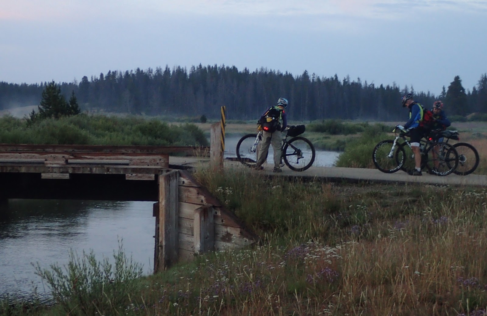
A brief pause at the bridge:

Another pretty view of the river and mountains in the early morning:


We hit the main Big Sandy dirt road, and I was feeling quite satisfied with my preparation for this section.  We had a nice ride down toward the TA, crossing Dutch Joe Creek along the way (scouting photo):


We looked at a couple possibilities for the start of our next trek as we rode by, but couldn't make any real conclusions on the fly.  No matter, we'd be back here soon on foot.

Boom, there's the TA right where I suspected - another scouting photo:


After leg 5 (bike #1, CP7) = 41:52:57, maintained 37th place

That went really well.  Quite an enjoyable bike section, and I don't use those words lightly  :)  And we were well rested and ready to tackle the next big trek.

Monday, October 2, 2017

Cowboy Tough - leg 4 (trek)

(Photos by Johan Lundahl, Tom Turley, and John Beard)

Time for the journey to begin "for real" - a long overnight hike with possibly challenging navigation, a 16 mile ridge to follow in the dark, and our first chance to find out if we belonged here or not.

Leg 4 - "Night and day navigation"
[38 miles of trekking, 100% trail, 10,200' gain and 8000' loss]

We found a spot on the edge of the road to work with our packs and gearbox and prep our feet.  A volunteer gave us some strange instructions - first we had to be off the road, then she was like fine, be on the road, but it's your fault if you get run over (?).  We didn't see a car go past while we were there, but apparently the guys kept a close watch for one :)


This trek was going to be quite remote, so there were a couple added required items to carry - a small tent, one sleeping bag, and a bear spray can.  The team put me in charge of the bear spray, I guess because I've had experience carrying it before, although I hope they understand I've never actually USED the stuff.

Not sure what this expression is all about, maybe I'm still thinking about how much fun that packraft leg had been?  Or maybe - "uh oh, my team also handed me the map and now they expect me to navigate"?


Setting up the trekking poles for the first big climb up to the long ridge:


Stoked to be starting this part still in daylight, not for any particular reason beyond psychological:


We followed a trail up the hill, easy enough starting out.  I would have loved to have scouted this section, but it was super long and hard to access, so I had to content myself with map study beforehand.  Here's how far I went up the trail when we last visited Jackson:


The first section of map (and before you get too spoiled with all the map photos, I have to warn that we didn't save all of our maps; some were tossed along the way to save weight.  I'm actually amazed we still have these).  From the TA we went uphill (ESE) to the ridge and then south-ish along the dark line of the ridgeline:


A couple race photographers had ventured up the trail - Johan got a nice photo of us coming up the valley.  We saw another photographer way higher up on the ridge but it was dark by then.  Looking good, Dave!


Dave was actually feeling the effects of the altitude, as we were climbing up to over 9000' and he had just arrived from Texas a couple days ago.  All of us made sure we didn't overdo the effort on this climb, as we were carrying a lot of water, food and gear.

We passed some wild berries and I suddenly realized I had missed something in this summer's scouting - I forgot exactly what huckleberries look like!  It has been too long since I've been in huckleberry territory.  Just to be safe, I bypassed the bushes, but I sure was regretting not knowing for sure if the berries were edible.

It was a long climb and eventually the sun started to set.  The scenery turned really pretty the higher we got, so Tom brought out the camera we were required to carry and starting taking pictures:


Wildflowers amid the aspens:


Team Vignette climbing well:


Gorgeous lighting above treeline as the sun set through the haze of distant wildfires:


We gained the ridge and turned south.  It was wide open up there, with splendid views as long as the light lasted:


A neat photo that I didn't realize Tom was taking - discussing the map with Dave:


The trail was still easy to follow, bringing us up one small rise after another.  The trail was bordered by various types of grass and vegetation, so I was happy when we took a slightly longer break so I could pull pants on over my shorts.  I never wear pants (besides orienteering pants) when I'm racing, but I started hiking with them this summer and found many benefits (leg covering, pockets, warmth).  So I designated a "dirty" pair and was really happy to have them along during the race.  Yay pants!

We all put on long sleeves as well, as it was chilly at night at the higher elevation (with some occasional wind).  I was really happy with my light wool top.  Time for headlamps too.

Here's part of the ridge we would follow all night long - 16 miles of up and down, weaving over and between little peaks.  I've never seen anything quite like this:


Still going, and going, following (approximately) the red boundary line all the way to the turn to the east near the bottom of this map.  Exciting!


We hiked along the trail, meeting a couple teams and chatting with them.  We were moving quite well, and I was encouraged to think that we might finish this leg in a decent time.  I followed our progress on the map, so far able to keep up with the slight changes in direction and small peaks that we went over and around.

There was a spring labeled on the map in the next saddle, but we had decided not to rely on it for water.  Good thing, because it looked like a mud hole, and soon after that we came upon a sign that said "Horse Camp" so it was also likely trodden by animals.

Here's where things got interesting.  We walked through the dark camp (deserted as far as we could tell) and continued in a generally "most-obvious" direction.  That's when a team came walking back toward us.  They claimed that the trail ended up ahead.  True, it was no longer much of a trail (mostly just racer tracks, probably).  We maybe should have looked harder around the camp to figure things out.

But we continued on, with me theorizing that maybe the horse camp was the end of the pack trail.  Ahead of us the slope turned steeper sideways and we watched another team contour along the side of it.  OK, that's not right.  We climbed up the small ridge to the left and it felt like we had regained the high ground.  Until we reached an opening into a wide-open field.

In the darkness we could see vague outlines of even higher ground, both to the left and a ways over to the right, plus a large peak not far ahead to the south.  The tall peak should be Pow Wow Point, and the trail should go around it to the left (east side).  The other interesting factor was all the headlamps in the valley to the west.  Tom questioned what they were doing and should we go that way?  My answer was that we don't want to be over there, and those teams *definitely* don't want to be over there.

But I was having trouble saying for certain what we needed to do, partly because the map was a bit challenging to read - 50K:1 scale, tiny contour lines, dark shaded colors, and all of this we were trying to decipher by headlamp.  To top it off, Dave was kind of out of it at the time, dealing with the altitude adjustment and mostly just trying to keep up physically.  He's normally as good at navigation as I am, but now I was left with no backup.  I suppose I should have thought this through beforehand - I've never been the sole navigator in an expedition race, but here I was suddenly in that role.  Yikes!

Mostly I needed to figure out exactly what I was looking at, as the ridge to the west was confusing me.  I asked Dave his opinion, and he pointed at a valley on the map and said he thought that was the high point, OK, nevermind Dave, just go back to working on breathing.  Finally I worked up from the valley to the east, coming up to the ridge with the trail on it, and decided that from the top of that ridge, everything to the east went downhill.  Who knows what's going on to the west, but that didn't really matter.

Looking east, it was steep uphill slope.  So we need to go up there, then.  Let's get to it.  Up the field, through the woods, with a break to sit on a log and eat a snack and let everyone catch their breath for a minute.  Then more climbing and finally through one last little field and we topped out - at the trail!  Woo hoo!  We probably could have made things easier on ourselves with a bit more thinking back at the Horse Camp, but our recovery went about as well as we could have hoped.

Back on track.  Now we could see other teams that were also heading the right way, and as we rounded Pow Wow Point we saw other racers come down from up above after recovering from Horse Camp errors.  For a while we were also back on a real trail.  But from there after it wasn't one we could count on.

It was quite helpful to stay in contact with the map, so when the trail petered out I could make the best suggestions about where to cut cross-country and where to look for the trail again.  Leslie was great about divining signs of trail and racer tracks in the dark.  We decided that we didn't trust any of the teams currently back here with us (well, navigationally anyway), but if enough racers ahead of us went a certain direction then we would start to believe it might be the right way.

We did a bunch of traversing along the east side of the ridge, some of it on rather steep slopes, some of it on an actual trail.  Or maybe a game trail.  Some of it picking our way cross-country.  We dropped down to a saddle as we saw racer lights up on the hill ahead of us.  The trail cut around to the left but then disappeared.  Racer tracks took off straight up the hill.  And I mean UP, like steeply scrambly up.  The map agreed.  OK, steeply scrambly up it is!

We made reasonably quick work of the ascent, with Tom towing Dave I believe.  Back on top of the ridge, which was now an obvious narrow strip of land with neat views to both sides.  I bet it's awesome up here in daylight.  For our part, we were VERY happy to be doing this at night.  Full sun and trying to conserve our water would have been brutal.

The team(s) ahead of us disappeared for the remainder of the night, while we gradually outdistanced the ones we had passed.  We were back by ourselves by the time we reached a long curving arc around a drainage, still moving well and figuring out the best way to deal with route finding (I keep an eye on the map and Leslie leads the way).

Happily the trail did not go over the next peak but around it.  That trend continued and we were thankful every time we looked up to see a higher point that we didn't have to climb up and over.  There were supposed to be a couple trails going down into the valleys on either side of us but we never saw them.  Not that we planned to use them, but it would have been nice for location verification.

We took a couple rest breaks in spots that were out of the wind and everyone seemed to be doing well.  We had reached the point of the map with multiple triangular peaks that all looked the same, and I couldn't always see them very well to keep a good count.  I wasn't too worried about missing the turn to the east at the southern end of the ridge, but I made sure everyone was aware that we should never go downhill too far without questioning it.

Dave was recovering, especially now that we weren't going uphill much, and it was great having another navigator brain to discuss things with.  The trail also kind of got a bit better and easier to follow.  Back to moving at a good clip.

Then... it went away again.  Right about when I was starting to look for the turn in the ridge.  We paused to reassess and decided to try climbing up to the top of the hill to our left.  Yep, there's the trail.  I called the turn just a bit early, but was relieved to see that the trail was obvious again when it did happen.  We made it along the 16 mile ridge overnight, yay!

The sky was starting to lighten as we took a break on top of the next hilltop.  We saw another team just leaving the area, perhaps after taking a break in the same spot.  It was a lovely scene, overlooking a huge valley with the early morning glow giving us something to look at finally.

Another nice photo by Tom:


From there we started down a steep slope toward Pickle Pass...wait!... we're going north, hold on... slight backtrack... OK, now we're starting down a steep slope (east) toward Pickle Pass.  Yeah, that was steep, enough to make us lose our footing a couple times.

Good morning, Tom!


From Pickle Pass we had to climb up the other side (steeply again, of course) and then we should head down a trail to find our first water source in many hours.  Here's the next section of map with that spot circled:


We were looking forward to a couple kilometers of downhill to the creek where we could refill the bladders.  Trekking in daylight, with wildflowers and lovely scenery:


It seemed I could follow the map more easily now - up the big climb, through a small saddle, over the top of a small drainage, then over two hilltops to where the trail should go downhill.

Good memories from that part of the early morning and an excellent selfie:


We started down a spur following a trail.  Until things didn't look right and the trail faded out.  Hmm.  Studying the map to try to figure it out:


Heading further down the spur, somewhat concerned that we were no longer following any obvious footprints or signs of racers ahead of us:


At least we had scenery to appreciate:


We mucked around for a bit, when we should have gone along with Tom's idea of climbing back up to start over.  The good news was that we were now near a little creek, so we were able to fill up on water without having to wait for me to figure out how to get off this mountain.

I started thinking if we just went downhill we should reach the main trail at the bottom and then we could go east from there - longer but at least it would solve the problem.  It seemed like we were still on "trails" although in reality it was just a huge network of cowpaths that was throwing us off.

As we started down, the spur turned even more west and I finally figured out where we were.  Stop!  We need to turn around.  I had been assuming a certain starting point from up top, but that had been woefully incorrect to the tune of maybe 500 meters or more.  The way the mountain spread out, if we continued west we'd be way off track.  We needed to work our way east to try to find the actual trail and not just these cowpaths we'd been wandering around on.

I realized much later that with daylight I had switched to micro-navigation (orienteering, at scales of 24K:1 or much less).  I had been so worried about the overnight nav that I relaxed when the sun came up and I got careless with the distances involved.  Plus we should have stopped way back when we realized not many other people had come down that way.

We worked our way from spur to spur, trying to find the right one but nope, not that one either, until it became super steep and we had to choose between up or down.  We could see two ponds below us and I thought I knew where we were.  Well, down seemed reasonable?  Except it kind of wasn't.  I'm not great on steep downhill so it was slow going, and it was a long way down.  Hanging onto sage plants to stop from sliding.  Climbing over downed trees.  Regretting the decision to go downhill.  I led the way as we angled east, feeling pretty stupid with my error and the time it was costing us to fix it (about 2 hours, I believe).

Grass burrs - I think we're not on the main trail anymore:


Finally we made it down to the creek where we stopped to treat and fill water, eat and drink, reassess, rest for a minute.  I was mostly upset because I had a plan for the next bike section (stay tuned for the next post) and I figured this delay was putting my timeline in jeopardy.  My team told me it was fine, don't beat yourself up over it.  I told them I was trying not to.

Well, nothing to do but get moving again.  Back on track, we found the path beaten down through the grass and heading up to the next small pass.  That led down to another creek, except this one was choked with willows.  I'm not sure there was any good way across.  We certainly didn't find one.  There were several options where other teams had forged various ways through, and all seemed to involve wading through water over and over.  It was cold water too.  And waist high in one spot.

On the bright side, my foot and knee (which had been aching a bit here and there) both appreciated the cold bath and came out the other side feeling great for the rest of the trek.  So there's that!

More willow pushing, then some climbing through tangled trees.  Finally we were free of the vegetation and back on a real trail.  We followed the creek upstream, stopping in the shade to rest up and refill water for the last dry climb.  Ready?

The final section of map for the first long trek:


It was steep.  It was getting warm.  We took a couple breathers part way, then we were at the top.  Yay!  I believe Tom took this picture near the top of this hill (maybe):


Now for a long gentle downhill walk out in the open sun.  At the first creek on the other side we took a quick break to splash ourselves down, and I think we lay down in the shade and closed our eyes briefly.  As soon as we got up, another team arrived, then another right after they departed, so we had some people to talk to for a minute and compare notes of our overnight experiences.

The first team took off the wrong way, which puzzled us but didn't change our plan to stay along the creek.  Eventually we saw them figure out their mistake and turn around.  We crossed the creek and followed along the left bank.  When the trail seemed like it might be returning to the hills we were briefly concerned, but it was just going higher up the bank.

Our team maintained a solid hiking pace, moving well on foot even after all these hours.  It took some mental fortitude to maintain it, when the trail kept turning in to cross one side drainage after another.  It was a long valley, and I underestimated how far we had to go.  We were pretty ready to be done with this and move on to the bikes.

Then there was John - hello John!!  We're a little later than we would have liked, but at least we're here:


John told us that there were quite a few bike and gear boxes still to be claimed, we were definitely not last.  In fact, he was surprised we were even concerned about being toward the back of the pack.  I guess we actually did OK then!

After leg 4 (trek #1, CP3) = 26:46:32, 37th place