The Wabash trail in southwest Iowa looked interesting - a long rails-to-trails path from Council Bluffs to the southern state border. Logistically straightforward, especially with John crewing for me, and a great way to see part of a state we hadn't been to before.
(side note - I'm attempting to keep up with my FKT reports, so these posts are bouncing west-east-west and back again - so no, we didn't drive from Wyoming to Iowa and back to Wyoming and next to Illinois...only virtually. I'll get my Gannett Peak writeup done eventually)
We made a quick stop at the Fill-R-Up near the trailhead (recommended from a previous FKT runner) and then snapped a couple photos before I got going down the trail. This mural has a nice overview, and between me and John I believe we saw most of the images presented:

We made a donation as our "user pass" for the day - thank you to the volunteers who helped create and maintain this excellent route:

Posing with the artful trail sign - Council Bluffs put together a nice trailhead on the northern end of the path:

My crew, trail buddy, travel partner, and photographer (side note #2 - both of us were taking pictures all day, so this post is extra-heavy on photos! I'll try to make up for that with fewer words):

An actual start line inspired this pose - ready, set, go!

And we're off, at a blazing 5 mph pace... OK maybe 6 mph at times, but let's not go too crazy with this.
I wonder what apple jacks are? Sounds good, we should come back when they're open:

Enjoying the wonderful green shady tunnel. I wonder how long the trees will last:

Deer! She stepped out onto the path, stared for a couple seconds, then bolted as I tried to reach for the camera. Her fawn moved even faster across the path. I've been having good luck with early-morning animal sightings lately. Just not always photographing them.

For several miles the trail is marked by 1/4 miles, nice. It didn't last, but was great for getting an early idea of how fast I was running (answer - a decent clip, hopefully not overdoing it):

A giant chair - ?? - if it wasn't up on the bank I might have checked it out to see if I would fit in it. I usually enjoy giant chairs.

John's vantage point from an overpass - hello John!

Apparently there are several ghost towns along the way, based on the rail line that used to run through here (right below my feet). Dumfries was the best marked:

Right about when I started thinking about needing a bathroom (and hoping I could wait until the next town), there was a rest stop with a porta-potty in the middle of nowhere! OK, I officially like this trail. I'm sure cyclists also appreciate this little oasis:

Normally I prepare more details in advance when I have a crew - where to meet me, where they can park, what I'll need. This time, mostly out of a time crunch, we decided to try more of an "on the fly" approach where John would figure things out and I'd see him wherever I see him. We figured maybe 60-90 minutes between water refills should work.
So it was always a pleasant surprise when I saw my husband waiting for me at the end of the green tunnel - hi John! Thanks for finding me again!

(side note #3 - Because John found some interesting sights while driving around Iowa, this report is interspersed with things that aren't on the Wabash trail - it's a combo FKT + travel post!)
Fun mailbox that John spotted:

John's view of the open road was way different from my view of the shady trail. Every time I crossed a road, looked left and right to see only sunshine and open sky, then ran into the trees again, I was dang happy to be where I was!

Briefly into the sunshine myself, and one of many, many cornfields for the day - we'd have been disappointed otherwise:

The only obstacle of the entire run:

More corn, on the way to the first little town:

Mineola has a nice trailhead:

I surprised John here, I guess I was running a bit faster than expected. He passed water and Spiz from the truck window and soon I was on my way again.

I love the little stop signs and street signs, sometimes even for a faded driveway in the middle of a field, sometimes for real roads:

I had no idea John was taking this picture:

Coming into Silver City:

Another quick stop and I was moving on. John hung around long enough to see the town jail (only from the outside though):

Most every mile had a numbered marker from the railway days. Early on I realized I had started around mile 407, which helped greatly in figuring out mileages. Mile 16 and feeling good so far:

It didn't take long to turn the iPod on - no bears to watch for, no nav to do, time for some Fastest Known Podcast listening. It's always fun to listen to Buzz while I'm actually running an FKT.
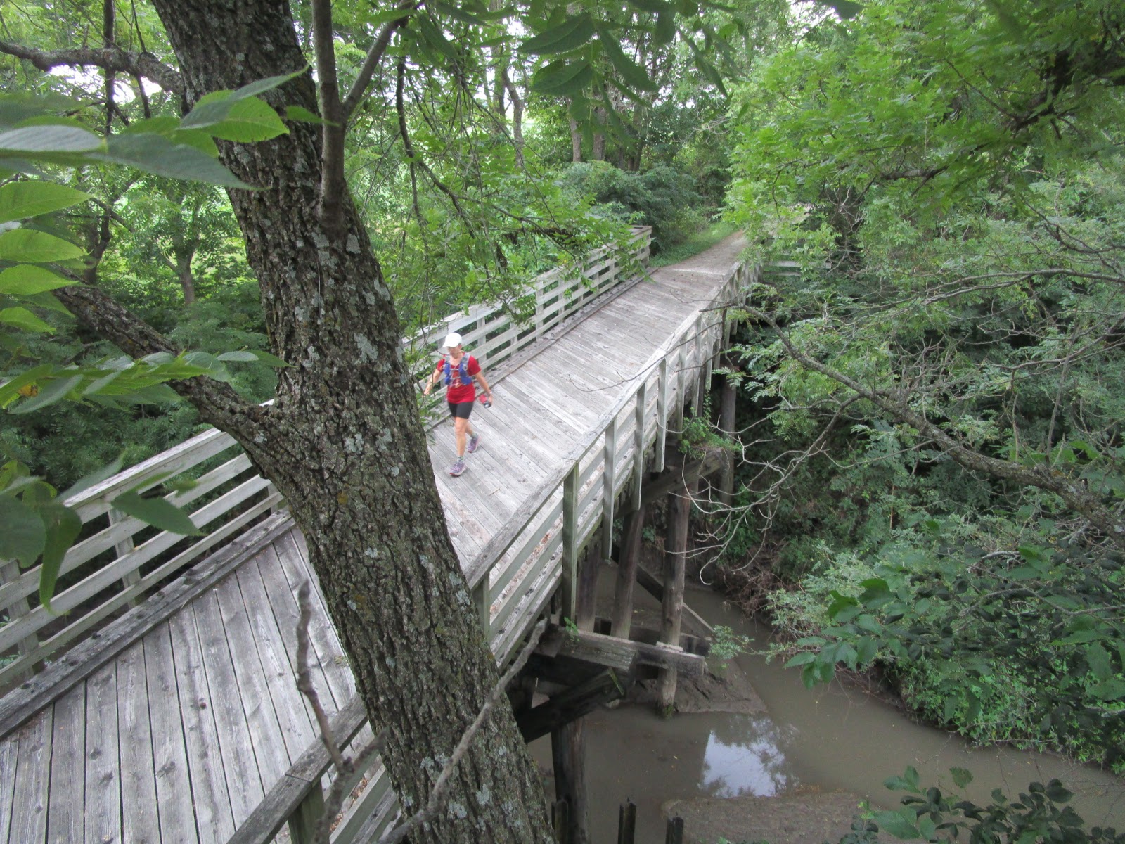
One of many railroad bridges:

And one of many rivers and creeks:

I'd read a run report where the guy said that it felt like much of the trail was uphill. It also seemed like it to me. I was sure the overall elevation chart (which I should have looked at in advance) would show a gradual climb. Nope! The whole thing undulates, gently up and then gently down, over and over, actually ending a hair lower than it started. I guess I only noticed the uphills. I didn't mind, I'd much rather have changes in angle than do the same thing all day. The illusion was just odd.
Coming to the underpass for Highway 34:

A mulberry tree (or bush?)! John got some berries for me, and also this photo:

John had plenty of time, and apparently found a great place, to practice with his aerial drone. They met me at a trail crossing, pretty funny:

Train on an overpass - which made me think, aren't I on an old rail line myself, and is this how trains cross paths? I'd never considered that before.

Malvern, yay! I couldn't quite help myself with this pose:

Both of us liked Malvern a lot. A nice trailhead with a water spigot and bathroom (with an AirBnB cabin next to it - ?). A convenience store and coffee shop for John. And some excellent outdoor art! This had me thinking of my friend Sheila who is currently riding in the Colorado Trail Race (go Sheila!):

John's tour of Malvern included several metal trees and plenty of bike themery (is that a word? probably not):

Malvern mural:

Metal tree with metal leaves:

And an oak version, very cool:

Back to the trail, where I'd worked my way up to marathon distance. Happily, everything had gone really smoothly so far. I think that's perhaps about how far that lasted. Hmm, that's not quite far enough. Still, not bad for legs that haven't done a ton of flat running lately.
Another excellent railroad bridge (and I'm probably about to notice how the trail "always goes uphill" after this):

Mile 31, about halfway there! Although my legs were less happy by now, I was still really pleased with my pace. I'd been thinking I might be able to complete this in 15 hours. Or maybe less? We'll see.

The afternoon was warm and for a while the sun was directly overhead so the trees weren't quite as helpful with shade. Occasionally I was running in full sunshine, but I was never overly hot. I picked the coolest day in the forecast, I think that helped.
Iowa cornfield with terraces, something I hadn't seen before:

A bit of shade in an underpass:

Imogene! This was interesting, another biker-centric rest stop. Hello John!

I didn't stay long, but John had time for some extra photos of the grain bin:

Inside is a table, sink, restroom, and showers - neat!

Showing the scale of the giant grain silos with a runner passing behind them:

John's sightseeing included the impressive St. Patrick Church in Imogene:

He met me at a road crossing a few miles later, and I happened to notice some writing on the back of the trail sign - someone had penned "YOUR" on it. Just that one word. Were they trying to write "You're doing great!" and then got interrupted? Or is there a deeper meaning? Something to ponder.
The word would have been easier to read in this photo except I wasn't backing up for a closer shot...

I got a kick out of these caution signs (the change in surface was such a non-issue) - although I suppose if you were riding a road bike with skinny tires you would appreciate them.

Another great mailbox sighting by John:

Mile 40! OK, my legs are officially wishing to be doing something else. I increased the frequency of my walking breaks in response. They begrudgingly thanked me.

Not your normal abandoned vehicle:

Another excellent river crossing:

Fun mural in Shenandoah - 73 bridges! Yep, I'd been over many bridges, I guess there were many more to go.

These next photos are to document the route through Shenandoah. John mentioned he'd seen a map describing the route through town with several turns, while I was under the impression I was just going to run down the main street. Nope.
First the route goes south on Sycamore, then east on Wabash. There's a good sign with an arrow at this turn:

At the end of Wabash you turn north on Center Street:

Back at the main road (Ferguson) you turn right to go east briefly:

Then another right turn into Waubonsie park, with another good "Wabash" sign:

OK, what? "Keep off bike path", I don't even get it. Is that for cars? For bikes? For everyone?

The trail T's into Argus Road, where there is no sign. Go right and cross this bridge:

Then left to return to the trail (also no sign, but it looks like the many miles of trail you've already been on). Google Maps has this drawn correctly, which helped me verify I was going the right way. No need for bonus miles on the one slightly-tricky part of entire trail!

Back to the lovely tree-lined trail:

I definitely hit a low point in here. A muscle in my left inner thigh was tugging at me, something new in my growing list of "past and potentially future" issues as I age. Was it an actual injury? Or was it just tightness from the long mostly-flat miles? Should I try to keep going?
Then my iPod battery died. I guess I can keep thinking about my legs uninterrupted for the next few miles.

I did a bunch of speed-walking, adjusted my posture a bit, relaxed and breathed, and found that walking felt about the same as running but was quite a bit slower. I guess I'll keep running then!
This might be the Isaak Walton Lodge?

Approaching my next pit stop - and I didn't realize at the time that the sign on the right was appropriate:

John's eye view of my approach:

I had about 13 miles to go, and I've walked a half marathon before so I figured I should be able to make it one way or another. I debated and decided to take an ibuprofen, hopefully not masking anything serious. That actually worked well - I could still feel the muscle complain if I pushed too hard, but it made gentle running a lot more comfortable to maintain.
So, maybe not the smartest thing I've ever done (side note #4 - I seem to be saying that a lot lately) but I decided to keep going. I handed the camera to John to lighten up the vest just a little. All photos from here on out were taken by him.
I was amazed that I could keep running (with some walking) at 12-14 minute miles. This trail really is an easy surface.
Somewhere down here I passed through the little town of Coin. Happy to see a real bathroom, also a nice little campground. It's great how many of these small towns seem to embrace having the trail pass through.
Moving forward:

I hadn't seen John in the bushes but our truck gave him away. "It's you!"

Still muddling through this thing:

"ROCK ENDS" - not a sign we're familiar with, but John got to experience the change in road surface from crushed rock to dirt. You learn something new every day.

Now John's up in a tree. He has more energy than I do at this point!
Evening light. It looks kind of dark, but I was way ahead of sunset (and a looming rainstorm).

I got a few sprinkles on me, no biggie, just a good bit of extra motivation to keep moving. John's view of one of my bridge crossings:

John's view of an Iowa cornfield and homestead, just lovely:

One of the last bridges:

Still running! Sort of...

And... that's the end! No really, that's all there is. Amazingly, I'd calculated that I'd finish somewhere around the "345 mile" mark, but didn't realize it would be right AT that spot. The trail just ends here. Works for me!

So happy to be done!
Just down the street was a sign for the Missouri State Line - we must be in the right spot:

Thank you Mr. Super Crew! Huge help today, including driving us back to Lincoln, Nebraska after our big Iowa adventure.

My splits:
Mineola - 1:44
Silver City - 2:31
Malvern - 4:06
Imogene - 6:56
Shenandoah - 8:53
South of Ikes - 10:18
Coin - 12:05
Blanchard - 13:24 (new overall FKT)
The FKT page:
https://fastestknowntime.com/route/wabash-trace-nature-trail-ia
3 comments:
Congrats on the FKT, and thanks for posting such a detailed report! I was planning to do this self-supported before I started having IT band issues this summer. With a full race schedule this year, I guess it'll have to wait till next summer. Nice work, and again, congrats!
Thanks Brian! It's kind of a long way to run on a bike path, at least for someone like me who is more used to trails. But an excellent experience - I hope you get to run it eventually. Hope your ITB issue is under control, have a good racing season!
Nicely done! I’m glad someone else has done this now. Sounds like you had a lot of the same issues I did, but in about half the time. :)
Post a Comment