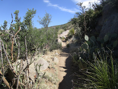
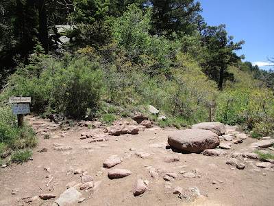
After what was supposed to be 2 weeks in Texas turned into 2 months, we are finally on the move again! It's mostly a "jump and sit" strategy, trying to be reasonable with the travel, while sometimes making things up on the fly because most of our plans for the summer have been cancelled. Basically, we're aiming for CA eventually, and along the way I was looking for someplace "higher, cooler, drier" after being in a relatively humid and gradually-getting-much-warmer place.
While we were on the way to my choice (Flagstaff!) we stopped for a day in Albuquerque so we could explore the trails in the Sandia Mountains. And there was an FKT available! And one of the trails just recently reopened! All good things.
I was looking to set a first female time on the Watermelon Loop. Coming from Texas up to moderate elevation (between 6,000 to over 10,000 feet), I knew I wouldn't be moving quite as fast as I might normally be able to. I hoped some recent hill repeats (up to 300 feet at a time, woo hoo) would help with the big climb up to the crest. And I figured it would be hot in the afternoon, but hopefully that would only be noticeable in the last couple miles down the hill. All that to say - my time is beatable. Also, the route is excellent; I highly recommend and encourage (women) runners to check it out.
Getting started, already happy to be back in the desert (finally!!)
I'm not sure why the FKT route map shows the starting point a short bit south of the end of the Pino Trail, but I started there to stay consistent with the way it was set up. I'd suggest that the Pino trailhead is a fine start spot instead (so the whole route is a closed loop, and technically you could start anywhere on it and go either direction).
Cholla! I have so missed the desert vegetation, even the things that could hurt me:
View of the mountain range I'll be climbing... just as soon as I traverse a few miles along the base:
A new toy! I finally splurged on a smaller, lighter version of the InReach tracker and I'm very pleased:
Starting the 365 trail toward the tramway, glad to be doing the "low trails" early in the run. I meant to start earlier in the morning, but it wasn't super hot yet (and I did enjoy that leisurely breakfast):
Fun swoopy trail, gotta love the paths that the mountain bikers build and maintain:
Occasional glimpses of the ridgeline to the east:
Can you tell that I was having a good time?
Most of the route along trail 365 was straightforward and well-marked. I could see someone accidentally turning onto trail 230 as "just another turn in the trail" but it is also marked and easy to avoid.
More difficult is the offshoot to Cedar Hill Road. And I knew this might be a problem based on the previous track and I STILL missed it. In my defense there was a lot going on right when I reached the key location - one biker coming down a rocky section toward me and another coming up from behind. Plus some hikers over to the left. The trail turns into a braided mess right in that spot. I even asked the 2nd biker if they all go to the same place and he confidently said yes. I followed what looked like the main trail (to the left) but eventually started going downhill toward the drainage. Definitely not correct. Coming back up, the guy was checking the map on his phone and shared with me that the actual trail was above us. I backtracked to one of the splits and proceeded up the hill.
I think every single person setting an FKT on this route to date has made the exact same error. To fix it: Stay to the right. Even though it doesn't look like the main trail. It is. Hope that helps someone in the future.
I climbed up toward the huge water towers and then had a fun little run down to the tram station:
Not open yet:
Next was the Tramway Trail into the wilderness, excellent:
This trail is narrow and occasionally not-so-obvious (I did one very short backtrack right at the start to verify I didn't miss something). It's nice that there are these helpful poles to mark the way in some places:
Loving the beautiful day and interesting trail:
I was surprised how long it took me to get to the switchback turn (just past the turnoff for "La Luz alt" I guess you might call it?), but it was super obvious when I finally got there - the end of a spur with a big valley opening up in front of you. Yep, time to make a sharp right!
Finally getting somewhere and starting uphill "for real":
I found La Luz trail and started up the switchbacks. More people on this side, but everyone was pretty good about staying apart from each other the best we could. Also, everyone seems to be on board with the idea of aiming their face away when saying hi. Makes sense to me.
Desert flowers (I am so rusty with the names of things; need to work on that):
Still super stoked! And my lungs were doing great with a moderate climbing pace, happily.
Getting closer to the fabulous rock formations:
Starting to get some views of the city:
Impressive rock walls along some of the switchbacks:
Flowers, trees, rocks, pretty views...
This was a rather dramatic transition to the upper mountain, with the dark spire suddenly appearing in front of me as I came atop a small rise:
Just a short bit of "is this still the trail?" parting of the vegetation, then it was clear again. I briefly rested in a shady spot before starting the next set of switchbacks, this time crossing back and forth over a huge talus field. I'm so out of practice with talus walking, need to work on that.
Aspens!! It's always a good day when I get to see aspens. I might have hugged one of them.
Gorgeous scenery, trying not to stop too many times to stare at it:
Ever upward into the rocky region:
I had a moment of "I should be seeing the split in the trail by now" so I pulled out my phone. Sure enough, the stars on my map indicated I might have just missed it. Not sure how though? I backtracked down one switchback and verified that no, I didn't miss anything. Hmm. I kept the phone handy and turned around to climb a couple more short S-turns. Ah ha! Here it is. Obviously.
Yep, I was never going to miss this intersection. Time for the traverse over toward the top of the tram:
And what a pretty trail! I spent a couple moments stopping to glance over at some rock climbers I could hear across the way (oh, I see them!), then looking back at the neat geology (with a little rock building on top that's about impossible to see in this photo):
And the ravens! I got totally distracted watching a pair swoop around and talk to each other. I think I saw one do a flip, or at least a practice roll. So, so cool.
Nice view of the tram building that I'm heading toward:
And while I have the camera out, here's Albuquerque:
There was some construction at the tram building, but nothing confusing (certainly might be more difficult figuring out the trails going north instead). I climbed the stairs to the overlook and happened to notice a "NOPE" sticker on this board. I need to get me some of those.
Another great view:
I didn't see any obvious trails right from the building, so I came down to the road below it. Looking back at the tram house:
And the route past the ski lift on the other side of the mountain. It's neat that there's a whole ski area here - you could take the tram up from the city and have a ski day.
Starting down the crest toward the woods and my next trail:
The Crest Trail was a fun change, weaving down through the trees, with some roots/rocks to watch for. There was a small split right before the one intersection (Tree Spring/10K), but I think both options go to the same place:
Another short section through beautiful woods to the veer-off point at the top of Pino Trail:
The top part of Pino is a bit overgrown but not too bad (and as far as I can tell, the oak leaves are not the poison kind, but possibly Gambel Oak?) - again, more study needed. Views back up toward the crest:
In and out of shade, admiring the views, listening to Malcolm Gladwell's "Talking to Strangers." As I descended it started getting warm, as expected, but at least I was only about 4 miles from the end:
Eventually the trail got better - way better, super curvy and flowing and fun! Finally running with some kind of "speed", that was excellent.
Another intersection I didn't need to be worried about finding, where a mountain bike traverse crosses Pino:
I want to go back up there where it's nice and cool...
Thank you to Charlie's Crew for adopting the Pino Trail!
A nice memorial and bench:
One more split near the bottom, well-signed:
John had hiked up Pino to the tram house and back, barely beating me back to the trailhead. We both had an excellent day on the trails. Thank you Sandia Mountains!
The FKT page:
https://fastestknowntime.com/route/watermelon-loop-sandias-nm
Subscribe to:
Post Comments (Atom)


No comments:
Post a Comment