I've been running on the Arizona Trail around Flagstaff for almost a year (off and on), and I always enjoy it. Smooth singletrack through ponderosa pine forests in the high desert, I love it! Last summer I discovered that the AZT splits into 2 options around/through town, and I immediately became interested in connecting those two halves into one full loop. While we're at it, let's see if it might get accepted as an FKT route.
It did, so I ran the whole thing yesterday. Finally, after months of thinking about it, scouting all the sections, rechecking the pieces that have been rerouted recently, and collating it all into one gpx track, it was time to get out there and see it all at once.
Oh, and my longer runs have been going a lot better lately. The pinched nerve thing is still here but it's not complaining as much (and I've reached a point where "more running" is helping instead of hurting). Yay for progress!
Yay for the AZT! Let's do this:
I started (and finished) near the Sandy Seep trailhead, going clockwise toward Picture Canyon. It was a chilly pre-dawn start, mostly freezing my fingers that were holding the water bottle and flashlight. Everything warmed up eventually, and the tradeoff was a lovely, beautiful day with breezes and no heat to deal with.
The bridge over Rio de Flag:
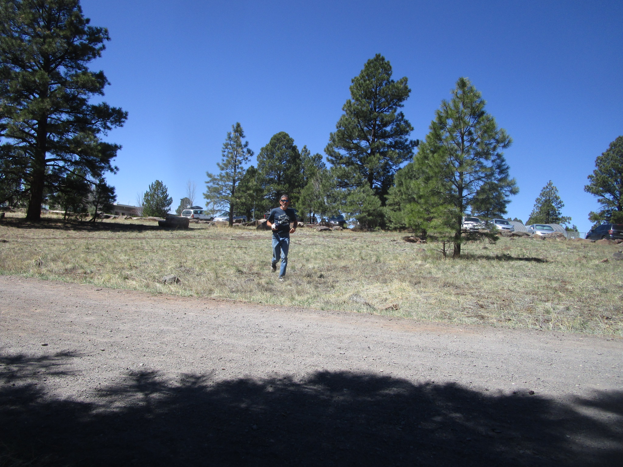
I haven't quite gotten my selfie method working yet this morning:
Looking back toward Elden hills and San Francisco peaks to see the pretty sunrise:
Improvement on the selfie-taking front:
I enjoy the trail heading east, but wow the highway and railroad traffic can be rather loud in this area.
See? I'm ready to cross under all three lines of traffic and start south to quieter territory:
I think this gate is new?
Live long and shadow:
John met me at the Walnut Canyon trailhead for our first crew stop, hi John! He treated me to some music and even a bit of dancing as a celebration of a fun weekend adventure.
I like the little drop down through a drainage system next to the main canyon. At least, I like it now that I'm not carrying a bike over the rocks (one of my prior scouting days was less fun here):
Good signage along the top of the Walnut Canyon rim - most of the trail is well-signed, making this route one of the easier ones to follow:
Looking over toward Fisher Point. Further on there is a short side trail over to the point, highly recommend if you aren't on the clock:
After descending into the canyon, looking back at the interesting geology. I started seeing other hikers at this point, but still way, way fewer than during the previous FKT run in Phoenix.
Next I found the point where the AZT splits on the south side of Flagstaff. I had been running on the "Equestrian" portion, now I was on the "no horses" section (I like to call it the "Pedestrian" side).
Partway up the hill, I sat to drink some Spiz that I was carrying. The baggie had leaked, bummer, but at least I double-bag it just for that type of trouble. Now if I could just keep from pouring it on myself... I spent a couple minutes using my extra water for a rough clean-up job. Good thing I don't do that to myself too often!
On my way toward town and the FUTS (Flagstaff Urban Trail System):
Mount Elden peeking through the tress - I would be circling the mountain, in a rather roundabout way:
I met a thru-hiker! He was walking north, eager to get to town for a shower and a bed. We chatted a bit; it's always inspiring to meet long-distance backpackers. Hope he finds less snow on the North Rim than Stringbean ran into.
Watch out for the "big" downhill...
Which leads to this pretty pond, and I'm briefly near the highway again:
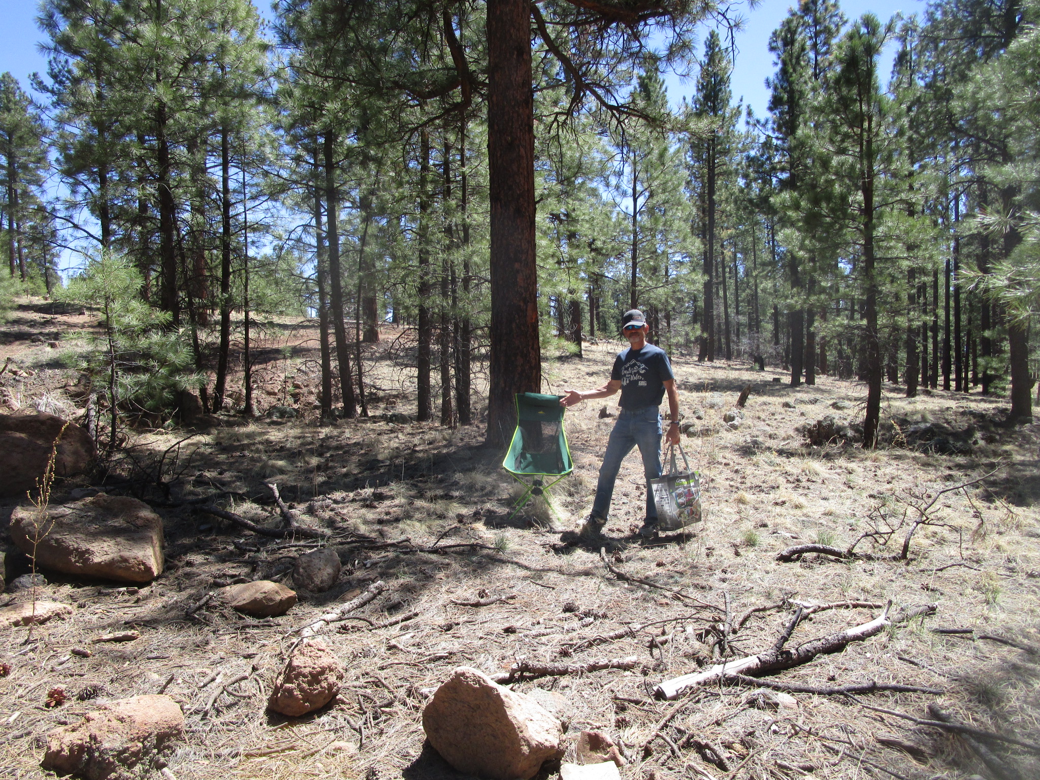
John had set up a little aid station for me, including our new excellent camp chair. I am very excited about this chair, perfect for a mid-run break:
A short section of sidewalks, with another view of the snow-capped peaks:
An excellent pedestrian underpass, and I think this tree is about to bloom:
Coming up to the one intersection that could cause a delay - I saw this train passing before I got there, but I was lucky to arrive as it had just left. Not only that, I made it to the traffic light at the perfect time and was able to cross without pausing.
The FUTS trail climbing up toward the mesa:
Running a wide circle around the mesa, with more views of the mountains. The snow is melting quickly around here, but will likely stick around up high for a while yet.
I like the walkway over the road, going into Buffalo Park:
John had our chair set up under a tree, but had to run back to the car for the bottle of Spiz. Thank you John! I didn't mind the brief pause, good chance to catch my breath in the middle of the long uphill portion of the route.
A tribute to Dale Shewalter, who helped create the Arizona Trail. Thank you Dale, much appreciated!
The section behind Buffalo Park has a ton of intersections, crossing the pipeline, the Loop Trail, and various other paths. The AZT is mostly well-marked, but it's good to keep a close eye out here:
Glancing at the barely-visible snowy peak on the horizon:
Following Lower Oldham for a bit:
I think there has been some work in this area recently to make the route more obvious, thank you to whoever is keeping up with the AZT around here. I've gotten off-route in training going in both directions, but this time I could easily following the markings. There is one section near the big rocks where it's still possible to get confused going the other direction, so I'd suggest scouting or following a gpx track closely through here.
Boulders at the top of the local maximum:
Merging back onto the Loop Trail, on my way to the Schultz trailhead:
Giant brush pile waiting for burn-acceptable conditions:
Hi John! The Schultz Pass road opened back up just last week, so he didn't have to trek far with the chair and crew bag. Time to load up with extra water and food for the "for real" climb up to the pass.
A recent reroute moved the AZT up to this new trail, above (and parallel to) the doubletrack that curves around the base of the hill:
Then it all comes back together; looks like they are trying to move parts of the trail up out of the drainage where possible. Recently there was a lot of snow here but it has mostly (finally) melted out:
Aspens and the turn up toward the road crossing to stay on the AZT:
Nice view and a good place for a short break in the middle of the climb:
The other split/merge point! Left = Equestrian, right = Pedestrian. This is the spot where I had the inspiration to create this route last year. Yay for FKT's and fun ideas!
One of many interesting rock shapes for the day:
It took a while as I slowly made progress up the hill. Getting a bit tired. Eventually I got to the top. Happy to be there, and happy to sit for a minute:
Super Crew Man posing for the camera:
Time for a downhill reward. Heading toward the fun descent on the other side of the pass - also, I wouldn't trust the mileages on the signs in this area:
Following backwards in the steps of Joe "Stringbean" McConaughy from his recent FKT run, and slogging through a bit of snow in his honor.
At least my snow experience was way easier than his.
Back to dirt trail, through a field, winding my way down the hill:
Last crew stop!
I approve:
Another recent reroute, on a windy trail that goes around that little hill over there:
You can tell it's a new trail by all the loose rocks. I'm sure it will get packed down eventually.
Coming down the last section, I checked my watch and saw that I could finish in under 11 hours. Sounds like a good goal! Back to where I started, 10:58 later:
Kip recently gave me his older GPS watch (thank you Kip!), so I've been carrying it in my vest to record the track. Here's why it doesn't fit on my wrist. Also - check out my smokin' fast 5K time:
Thank you sweetheart, you rock!


No comments:
Post a Comment