An FKT run attempt - it has been a while! I have a few on my radar, just haven't gotten things to line up properly lately. Since we're in Phoenix this week for John's solar class/conference, I was hoping to have a chance at the National Trail. Normally I would have opted for the longer out-and-back, but some recent longer training and a small Achilles niggle made me rethink that.
The great thing was that the weather changed in the past couple days. Instead of highs in the 90's, the morning was in the 60's. Too good to pass up.
Originally I was going to park on the west end and take a Lyft to the start on the east side. Elevation-wise, this made sense since the west terminus is a couple hundred feet lower. However, when I drove there I didn't see an obvious place to park - it's a dirt road with private property signs and no trailhead parking (not to mention no obvious trail). On-the-fly problem solving, a useful skill for FKT's. I drove back to our AirBnB which wasn't far away, and took a Lyft from there. Post-run transport would either be another ride share or perhaps I'd feel good enough to trek back.
Doing an FKT on zero scouting is always at least a little risky, but I was OK with the possibility of failure for this one. I also had to beat a previous time set last month by Rachel and Julie, and there was the above-mentioned Achilles liability (which thankfully was never an issue).
Armed with a turn sheet and the map downloaded to Gaia on the phone, I was ready to roll:

Go that way:

Up the dirt road for a bit over a mile, to a view of some ruins that would be interesting to check out another time:

Happily the trail is super well marked, just pay attention to the post at each intersection and there shouldn't be any question about where to go. Thank you, trail people!
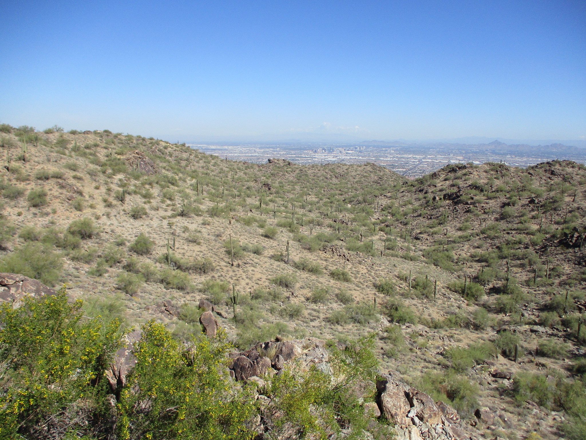
First view of the city, climbing up the long (but not steep) hill for several miles:

Hello, lone saguaro!

An occasional rocky section to keep things interesting in between the runnable ones:

It was nice having frequent intersections so I could keep an eye on the distance and my watch. It was really nice that my legs felt springy and happy - what a lovely day!

Looking over toward downtown Phoenix (hello John!):
Someone put some work into these steps leading up to an overlook:

Following the purple "N" markers to the next trail section:

One of the few roads up into South Mountain Park:

As I was in kind of a hurry, I was taking pictures mostly on the move. Surprisingly, many of them came out decent. I didn't crop a single photo in this post.
The road crossing on the way to the traverse below TV antenna hill:

Desert flora:

Thumbs up for this trail and the excellent markings!

I knew I was taking too many pictures, but sort of couldn't help myself. I had two hands free, since I was using a Camelbak bladder instead of the usual hand bottle, so it was easier than normal to whip out the camera whenever the mood struck.

After the descent to Telegraph Pass, the trail took a steep upward turn. At least it wasn't a huge climb, and I was still feeling great.
Scenery to the south - so many great views:

Another interesting stone structure:

At the top of the climb I followed the trail along a long ridge - pretty! I really like this section:

It made me happy :)

Just avoid the pokey things, as the trail traverses the side of the next hill:

The National Trail continued along the ridge, up and down, occasionally meandering. I didn't see every side trail that was marked in Gaia, so for a time I lost track of my exact location. Just keep moving west as fast as you can, toward the Estrella range in the distance:

One of several holes in the ground, I assume part of the "lost mines"?

My downhill speed on the slightly-technical trail wasn't quite as fast as I'd hoped, so I got slightly concerned at my time when I found the intersection with the Bursera trail. I hustled down the rest of the descent and over to the little saddle that marked the entrance to the big valley I needed to cross.
Another photo on the fly that came out surprisingly well, on my way to the ramada near the Bajaha trail (the "Bajaha ramada"):

I followed the trail around and through a couple small washes, past an intersection where the Maricopa trail takes off, and up to the next trailhead:

The San Juan Lookout is a nice spot with a great view, and possibly even the end of the National Trail proper (per the signpost). Except it might rarely be open for vehicle access, so the FKT route continues on just a bit further on trails.

This was the only spot I needed to check the route on my phone. It took a few seconds to figure out the right direction, heading for a low saddle and down the other side toward Estrella Drive.
The odd thing is that the trail ends at a barbed wire fence and no obvious trailhead. A bit weird, maybe this access point is something the park is working on?

Anyway, this is clearly the end of the route, and I was psyched to make it in plenty of time. Fun run across South Mountain Park!
I even felt good enough to walk/jog back to the AirBnB for some bonus miles. Happy to get this one in before summer arrives soon.
No comments:
Post a Comment