Previously on "
SHR Hiking Trip 2023", we had climbed out of Mosquito Hell and were ready to ascend further up into the high country. Time for an off-trail extravaganza and a visit to my favorite place (so far) in the Sierras.
[Photo credits include Cathy Cox and John Beard]
I believe day 4 was when this picture was taken (once we got the camera to stand up on its own). Hello friends!
The day started out briefly overcast for once, perhaps a sign of unstable weather in our near future. Our quite-passable campsite from the night before:
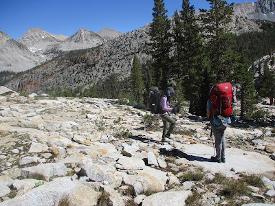
It was a lovely morning to walk in that direction:
We were aiming toward Bighorn Pass, by way of Laurel Lake. I had wanted to detour over to Grinnell Lake because it looks so pretty on the map (like I can really know these things), but we ran out of extra time and had to stay on the main route instead. Another time, perhaps. Really, we were just amazed we hadn't completely blown up the schedule with the day 2 detour.
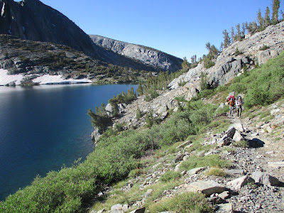
Laurel Lake is nice too:
Two big boulders, a waymark in the Roper book - seems like we're going the right way:
The climb up toward Bighorn Pass looks fairly intimidating from lakeside. We followed John up a little here, a little there, always finding a way that was steep but easily passable. Thank you again to all the people who created and documented the SHR so we could be here!
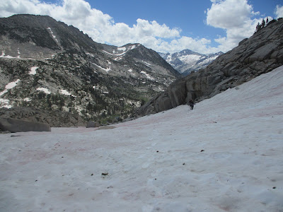
Back into the snow with a gentle climb toward the col:
Admiring where we'd come from and happy with the weather - so far:
I'm not for certain, but I believe this picture is right below Bighorn Pass. John went on a little scouting mission and reported "all good, come on up!"
Rosy Finch Lake on the other side, another beautiful body of water in the Sierras:
Our first look at the technical, rock-covered traverse above Rosy Finch. John and I had done this in the opposite direction so we knew it would take a while even though it's not far in distance:
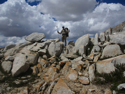
Finding ways through the large boulders, all of them stable, kind of like a natural landscape maze:
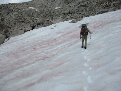
With the additional "snow factor" now and then, which by this point we were getting better at:
Sometimes it was even a simple walk, and we appreciated the break from scrambling and footstep-kicking:
So far so good, but let's keep an eye on the clouds...
Yep, we're coming John:
Hello Marmot! We didn't see (or hear) as many marmots this summer for some reason, so it was nice to spot one and even capture it on camera:
Another section of maze, super fun:
Then the rain started, less fun. John realized he had lost his pack cover somewhere early that day, so he improvised with a trash compactor bag. We previously used them inside our packs to protect stuff from rain, but recently we've grown fond of the pack covers instead - easier to manage, as long as you don't lose them.
Just as we were about to reach "Shout of Relief Pass" (that's really the name), we heard thunder. That got us scurrying over the pass and starting down the other side. Another north-facing slope, so of course there was snow.
Happily, by this time we were all ready to get on our butts and glissade. The snow made our descent quicker than climbing down rocks, especially helpful for potential storms.
More glissading down lower slopes, and I have no idea how the sky is so blue in this picture when it was raining not long beforehand. I believe the word "schizophrenic" was used several times.
Heading down the valley into another granite park, aiming for Cotton Lake (and this sky is more like I remember):
This area feels magical to me. Flat granite all over the place, amazing views, tiny alpine ponds, singing birds. I could live here for a week.
For the moment, though, we were rushing to beat another bout of rain. We hurriedly picked a couple tent spots near the lake - thankfully not taking the one that was about to be swamped with rain runoff. Cathy and I jumped into the tents, John wandered around to watch the deluge for some reason, and Robyn discovered that her jacket was no longer waterproof, dang it.
Eventually it cleared up again, we had dinner, and we met our neighbors from the tent across the way - a couple from Australia who hiked all over the Sierras (and Australia and New Zealand mountains) to gather stories and write books. It was nice to meet other people for the first time on this trip.
Day 4: (Note that I took input on this one, and it might be colored by Robyn's experience with her leaking jacket)
Why does Roper lie?
There was some despair up there
No shout of relief
Sunshine in the morning, yay! This place (I call it Awesome Camp) makes me smile:
Twin tent drying:
Such prettiness:
Time to leave, I guess. We descended past Lake Isaak Walton toward Fish Creek:
As expected, it's Mosquito Time again. Also creek crossing time. I'd forgotten that the trail jumps back and forth over the creek. The water was higher than last time, not terribly difficult as long as we were careful.
Except that during one of the crossings, Robyn stumbled a little and managed to soak the bottom part of her pack, including their tent. Dang it! So much for all that careful drying in the morning.
She started up the trail with pack dripping. I said she should lean to the right, which created a stream of water pouring out. At least that made us laugh!
Partway up the hill we paused for lunch and a view. It was a good time to dry some gear - and some shoes:
It's a good thing we were in a good mood, because not long later Cathy had a sunscreen stick catastrophe which turned into a minor "garage sale" of stuff along the trail. I'm not sure how that happened. I am sure we giggled for some time (and thank you John for focusing on helping instead of just documenting like I was):
Finally getting our sh*t together... we were on the John Muir Trail for the afternoon, strolling near lovely Lake Virginia:
Excellent high mountain flower arrangements:
Duck!
Snack break near Purple Lake, with the (now standard) grey afternoon clouds building up:
Somewhere in this area we started hearing from passing hikers that there was actual weather coming in. You mean, besides the afternoon/evening showers we've had every day? Yes, apparently worse. At least our timing was half-decent, with only one night out remaining.
We hustled a bit to traverse around and up to Duck Lake while it wasn't yet raining. Last time John and I were here, there were quite a few other people. This time we had the place to ourselves and the pick of the campsites - well then, we'll take the one with the excellent view!
Hearing some "quack quack"-ing, we investigated and discovered actual ducks on Duck Lake. Well, that's appropriate!
Then we hid from the rain for a little while, coming out of the tents when it cleared up so we could make dinner. Cathy captured a lovely sunset photo that evening:
Day 5:
Sun in morning - dry!
Too many creek crossings - wet!
O S M R ducks :)
Last day on the trail - sad but also thankful we were going to miss the hurricane that blew over California a couple days later. We'd thought the weather was wetter than normal up to that point. Not hurricane-level though!
Another beautiful blue sky "isn't this great?" kind of morning:
I would love to visit Pika Lake someday! With a name like that, it must be awesome.
From the saddle we did some off-trail travel toward Deer Lakes. There have been a lot of people here in the past years, so it's really more of an easy-to-follow use trail by now. The pretty lake basin:
Columbine flowers, yay!
Clouds drifted in early that day, as we climbed up toward Mammoth Crest. Since we were going to be up high for a while, we kept an eye out for anything menacing, thankfully not seeing anything that caused concern.
Still, we didn't dally. One quick photo to admire the notch in the Crest and then continue on:
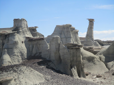
Soon we were in my favorite landscape of the day, so otherworldly and odd. And flat.
We had options to descend earlier than planned, if needed for weather considerations. Happily we didn't need to use them. As we started our final off-trail section, a group coming our way paused to ask if we knew where we were going? Oh yes, we're trekking to the scree descent. Good on them for making sure we weren't going to get ourselves stuck up there. But we're OK, thanks!
It's always interesting standing at the top of this big drop down the sandy slope. After all our glissading practice, it turned out to be pretty tame for all of us:
We found the next trail and had a jaunty little walk down to Horseshoe Lake and the car. Another week on the SHR, complete!
Day 6:
Last day on the trail :(
Mono Crest variety
Descent on scree - whee!
Thank you friends, that was totally awesome and enjoyable! Let's do it again sometime.


