Arizona has some excellent peaks to explore, and we spent several weeks in September/October seeing one "old friend" and some new ones too.
I got really lucky with timing on our return drive from the Collegiate Loop heading back to Tucson. Our friend Taylor hosted us at her house (thank you Taylor!) and cheered me on when it looked like the Hole to Hump FKT might be in the cards. "Hole to Hump, Hole to Hump!" she rallied - too funny!
Previous experiences on either end of this route helped with the planning, and of course any time we get a chance to head down into the Grand Canyon, I'm pretty sure I've mentioned before that we will always be excited about it.
I mean, come on:

We wandered down the New Hance trail in the morning, following the bottom wash to the river:

Nature is so cool:

Once again we just happened to be at the river in time to see some rafts, in this case park service motor boats. They zoomed right over the rapids like no big deal:

Hello from the Colorado River!

Admiring the surrounding geology and layers:

Firing up the InReach Mini to begin tracking my progress from the "hole" to the "hump":

I wrote a fairly detailed report, with a few more pictures, on the FKT website.
Briefly... the climb up New Hance trail was warmer and slower than my previous ascent, but still reasonable, and very much still pretty:

The roads across the prairie were in great shape for running and driving. Good thing, because I needed to run as much as possible to have a chance at the fastest known time. John crewed me every few miles and took a couple pictures while it was still light out:

Overnight was dark, cool, calm, mostly straightforward. I kept on running, all the while wondering if I had it in me to climb Humphrey's Peak fast enough the next morning?
We started up the mountain right around dawn and John led the way straight up the ski slopes. A couple months after the fact, I still remember how difficult this climb was for me - one foot in front of the other, keep breathing, keep stepping, don't think just follow. You get there in time or you don't. Adrenaline must have helped, I can only imagine.
Wind at the top was crazy! That was the only negative part of the forecast. Luckily it didn't delay us until the very last little "hump", where I actually crawled up the final few rocks. Thank goodness for the protective barrier built up at the top for a bit of respite:

So excited to have made it!

Fun timing, as this just came out recently:

I'm always interested in seeing the FKT of the Year nominee list, because it's a wonderful celebration of all the incredible accomplishments in the last 12 months:

And wait - what?? - someone nominated me, first time that has happened! Makes me smile to think about it. Thank you to whoever recognized that effort! I am humbled and honored to be included with many other inspiring and talented women.

Continuing south through Arizona, we stopped at the new Sedona Rivian EV charger, pleased that this is here now:

Looks like someone has been driving on dirt roads:

Back in Tucson, ready to tackle my ever-evolving list of places to roam in the mountains around the city.
First up, a mountaintop we can see from our RV park (and many other vantage points) - Rincon Peak. It's pointy and remote, and it took a bit of a drive just to get to the trailhead on the back side. Happy to finally find the time to make the trek:
Up on the saddle between Mica and Rincon, with the summit on the horizon:

The final climb is steep but way more doable than I had suspected after seeing the peak from an airplane window last year. The giant cairn on top, with broad Mica in the background and the Catalina range in the distance:

A distinctive Alligator Juniper as we started down:

Another distinctive... something:

THIS apple?

Scat, bear, scat! (Or as I like to yell in a cheerleader voice, "go bear go!")

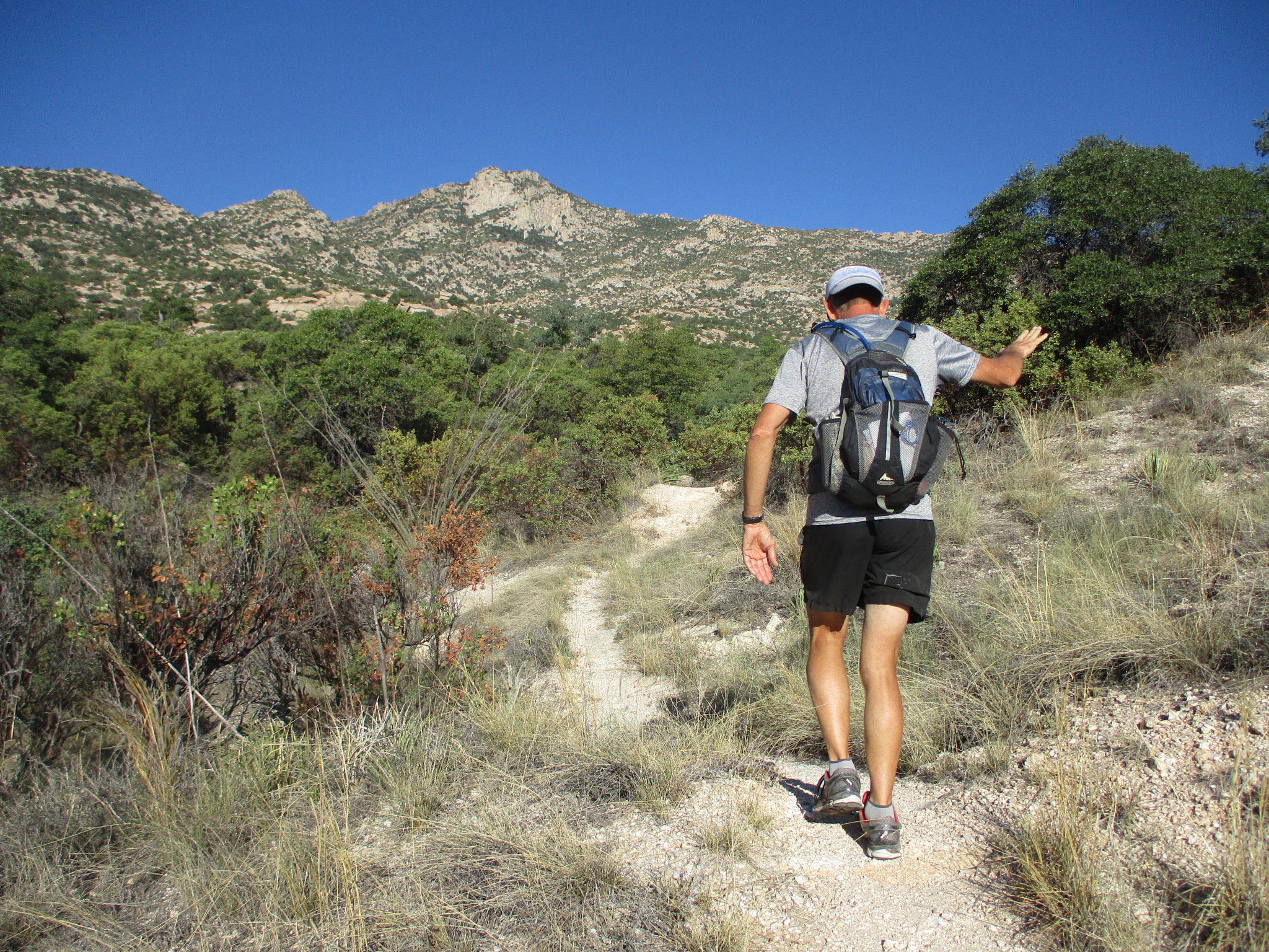
Let's see, what's next? Ah yes, something shorter but even steeper - Pusch Peak. It's the lowest high point on the western end of the Catalina ridge, with a sort-of-a-trail that feels like it goes straight uphill even though it looks like a roundabout traverse.
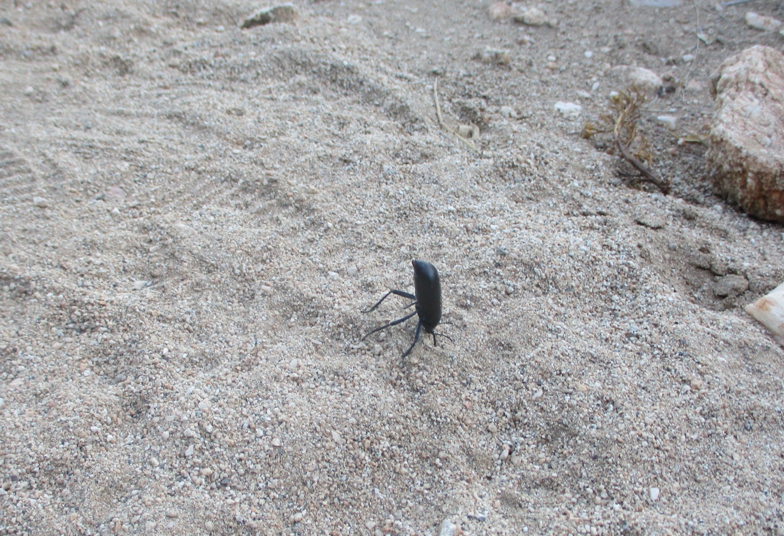
A headstand-y bug welcomes us:
View of town from within an early morning shadow:

Two thumbs up for adventure!

Photogenic prickly pear:

Made it to the top, with the reward of a view toward Bighorn Peak and then Table Mountain just visible over the top of Bighorn:

Which apparently got us wondering about Table Mountain. It's such an obvious and curious feature from most of the Tucson area. And it's climbable (at least outside the "Bighorn closure" months). Let's try it!
View of Table from the Pima Canyon trail (and I realize now that I don't have any good photos of Table Mountain from further away, which would give some context to its shape - I'll have to work on that for a future post):

Starting up the off-trail ascent, with slab walking and rock hopping and pokey plant avoidance:

Looking down the slot toward Oro Valley, as we're about to reach the table portion of the mountain:

An excellent vantage point from the top. I believe that's Catalina State Park down there:

One of the spiky plants to avoid - although as much as a barrel cactus looks sharp and nasty, we've had very little issue with them. Probably because they are obvious and sometimes come with pretty flowers. And I've probably jinxed myself now.

On our way down to go search for some ice cream:

We're enjoying our return to southern Arizona for the winter, so much more to see!
No comments:
Post a Comment