We've seen pieces of the Colorado Trail here and there, so when Robyn suggested we meet up to spend a September week trail running together to explore more, we were immediately interested. Seems like she felt our Softrock completion last summer was a positive experience, at least enough to invite us for more Colorado wanderings, yay!
The trail goes from Denver to Durango, with a divergence (east and west options) around the Collegiate Peaks. Someone coined the term "Collegiate Loop" for the concept of doing both options in a loop of about 160 miles. With 3 of us and one Tug-E, we took turns running together and driving between trailheads. The plan was to complete the loop with at least one of us covering every section.
Day 1 began at Monarch Pass, where it was chilly and one of us was OK being cold for a few miles. Happy to be back on the trail with Robyn!
Looking back toward the pass, a spot John and I have driven by many times without stopping to hike/run. That ends today!
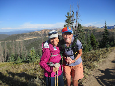
We met a few mountain bikers and had some fun conversations with a group of women. "How old are you?" they wanted to know. One kindly took our picture:
The smooth path along the crest, enjoying the morning sunshine and being happy to be on foot instead of in a saddle:
We were at the southern end of the loop (where the Colorado Trail merges and continues south), taking a left to start up the east side of the mountains. From there we would drop down into this valley and head back toward our campsite at Angel of Shavano campground:
We had dropped John off at the bottom of the hill so he could climb up to Monarch Pass. He climbed so quickly that we were barely into the trees when he appeared. Hello John!
A lovely, wide bridge over the creek:
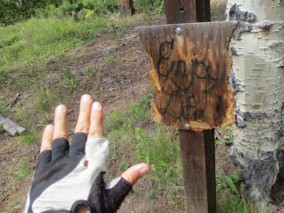
Enjoy life!
One day done, an excellent start.
The map of the loop - day 1 is in red, day 2 is magenta plus most of the next blue section:
The next morning Robyn and I set out early for our almost-15 mile trek together. There were lots of ups/downs, ins/outs, a few cows that didn't want to leave the trail, and some interesting little pine cones:
Not sure what's up with this, but it could be a decent campsite for a through-hiker:
Making good progress and having zero nav issues following the CT past all the well-signed intersections:
We barely beat John to Chalk Creek road, where he apologized for being late but we completely didn't care because he brought us delicious pastries!
Robyn and John took on the 4.6-mile paved road section next. They passed a neighborhood with a "Kindness Rock Garden" - love it!
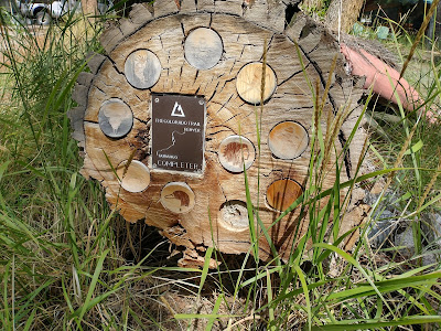
Also an amazing bit of art at the end of a large log:
I drove up to Mount Princeton trailhead, ate a bit of lunch, and greeted my friends a short while later, hello friends!
One final section for the day. John joined me, and Robyn drove around this time. I think it rained a bit (normal Colorado afternoon) and I didn't take any pictures. More traversing and climbing/descending, enjoying the trail as it crossed above the Buena Vista valley. We remembered biking this trail once and I was again glad to be running it instead.
We camped at the Collegiate Peaks campground that night, super convenient. All of us were starting to appreciate having Tug-E there for the electric plugs (kettle, electronics charging, Waterpik) and the warm interior for eating supper and breakfast. Luxury car camping!
For day 3 we discussed a few possibilities based on the widely varying lengths of the legs. John was up for finishing the last bit of trail along Cottonwood and then going over the next big pass. I was ready for the pass plus the long 18+ miles to Clear Creek. Robyn wanted to do the long section, and given the chance to start as soon as she parked the truck instead of waiting for me, she thought that would be great.
It ended up unintentionally structured as a "chase" day, although only John and Robyn were thinking about it like that. I was going to go for a run with my mp3 player and enjoy the scenery.
They dropped me off at the base of the climb to Cottonwood Pass and I had a lovely start to the day with a beautiful sunrise over the nearby peaks:
Into the wilderness:
It's a long climb so I tried to stay steady, wondering if John would catch me. Robyn had dropped him off 2.2 miles further back on the trail and he is a strong uphill hiker. I made it to the top alone, then met a through hiker on the other side. She was fun to chat with, and she also mentioned something about snow coming in a few days. In mid-September -- OK then!
I ran down the other side to find Tug-E at the next trailhead, and no sooner had I arrived then John came dashing up the trail. Too funny! I laughed and took a picture as he bent over to catch his breath:
Starting the next long section, I couldn't decide whether to keep my jacket on or take it off. Oh, then I need a snack. A few minutes later, I should filter water. If I had been trying to gain time on Robyn (which I wasn't), none of this was helping. It was a good thing I was solo at the time. Finally I got myself together and got moving.
I spent the rest of the day listening to podcasts and appreciating the world around me.
A section of the CT I'd seen in a prior year when hiking up toward Mt Harvard:
And a bridge I'd passed during a prior hike up Pine Creek - I was loving all the little flashbacks in addition to all the new things I got to see this time.
The only bit of mud I found the entire time, seemed worthy of a picture:
Yay for an amazing aspen grove!
John and Robyn found us an excellent primitive campsite at the reservoir and had plenty of time to set up before I arrived. Another nice night of sleeping under the stars. Well, inside a tent.
Day 4 was all about reaching the northern end of the loop and starting back on the west side. Robyn had seen this portion before, so she led the way along the first 11 miles.
It was great to walk out of camp and start up the trail. We spent the morning looking at random aspen trees that were starting to change colors, so pretty.
One of Robyn's photos, perhaps from day 4:
We were chatting away and I almost continued north on the Colorado Trail toward Denver, but Robyn helpfully made sure we turned left instead. There's kind of a lot going on with this sign, not sure how I almost missed it.
It's a blue day at Twin Lakes:
Such interesting lighting, with Mt Elbert on the horizon:
We took a tour of the buildings at Interlaken, an early resort that is now a historic curiosity:
Admiring all the details and beautiful woodwork inside the house:
Another building, now boarded up. Would have been fun to be here back when it was open:
Robyn and I had a fun run along the lakes, over to the trail intersection where John had hiked in to meet us. Hello, fellow goofball!
Robyn and John took off up the trail toward Hope Pass. I had a couple hours to check out the Twin Lakes store, open email for a moment, and then drive around to the Winfield road. Robyn was waiting at the trailhead (oops! Y'all were fast) and told me John had started along the last trail section already.
He seemed to think I would catch him, but after hiking uphill and then finding the new (to me) somewhat technical trail, I was pretty sure I wouldn't.
When we ran the Leadville 100 in 2009, the course went up to Winfield and back on the road. Now the race follows this trail instead, which is nice for getting off the dusty road, but it's definitely harder and slower. And more elevation. I was glad to see it outside of a race.
We camped at a dispersed site near the trail, excited to take on a long single stage tomorrow that included a reroute. So far, so good!


No comments:
Post a Comment